Virginia Tech Smart Intersections Pilot: Potomac Yard Metro Station
Project Background
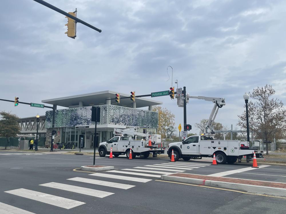
This pilot has been deployed in partnership with the Virginia Tech Transportation Institute (VTTI). Three devices were installed at the corner of Potomac Avenue and East Glebe Road, directly adjacent to the new Potomac Yard Metro station. These devices measure turning movement counts and identify near misses between road users, providing key information about this intersection's safety and travel patterns amid rapid change to its use. The data from these devices will be analyzed by our research partners at VTTI, helping us to validate their accuracy and learn which tools are most effective at scale.
Alexandria Named Winner in IDC Government Insights’ Seventh Annual Smart Cities North America Awards!
Alexandria has been named a winner in IDC Government Insights’ seventh annual Smart Cities North America Awards (SCNAA). Alexandria was recognized for Smart Intersections in the Transportation category. The awards were designed to recognize the progress North American states and municipalities have made in executing Smart Cities projects, as well as provide a forum for sharing best practices to help accelerate Smart City development in the region. To learn more about this awards program, visit HERE . Winners will be honored at Smart Cities Connect being held May 7 - 10, 2024, at the Raleigh Convention Center in Raleigh, NC. To learn more about the event, please visit https://spring.smartcitiesconnect.org.

The Technology
These three technologies have been deployed simultaneously at the intersection of Potomac Ave and E Glebe Rd, and their results will be compared against a "ground-truth" system monitored by Virginia Tech researchers. Each system uses video or LiDAR to provide similar but distinct information about vehicle and pedestrian behavior, which is used to understand the safety and efficiency of the intersection. This pilot is a way to evaluate which systems are accurate, sustainable, and usable by city staff.


The Data
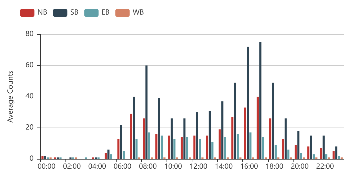
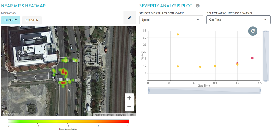
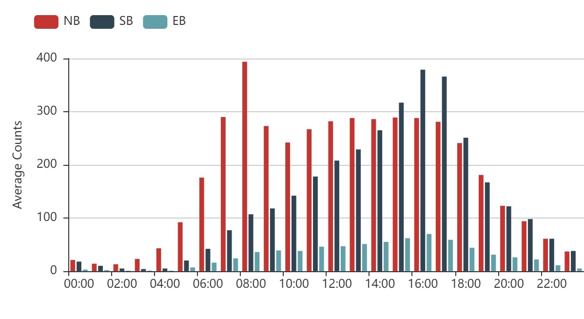
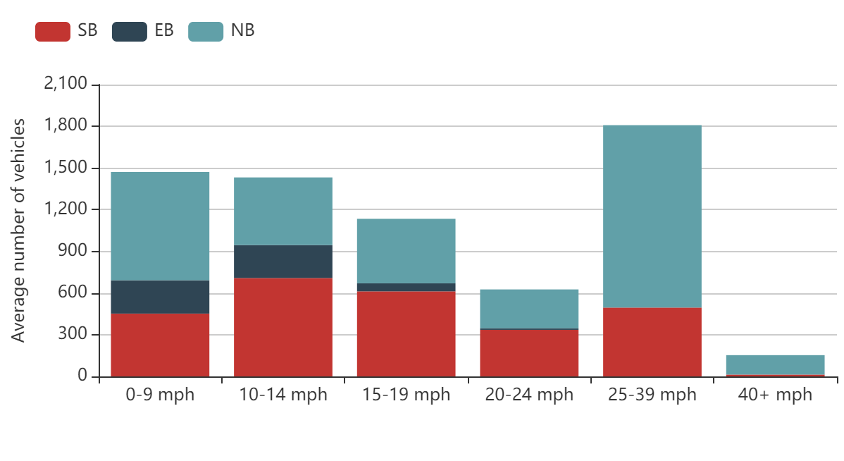
The three devices deployed at Potomac Ave and E Glebe Rd provide a stream of anonymized data to Alexandria's traffic engineers. This information is used to understand travel patterns of drivers and vulnerable road users (VRUs) to improve both safety and efficiency of the intersection. Engineers are also assessing the usability of the data coming from each device to better understand what tools would be helpful in other areas of the city. The graphs below highlight the types of information that the technology is providing.
Event Statistics by Time of Day
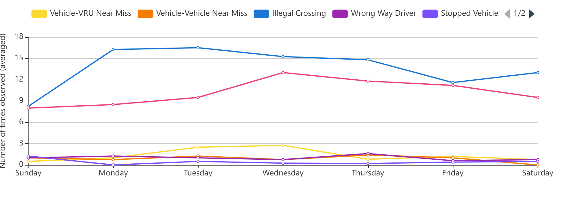
Near Miss Analysis
Vehicle Counts by Turning Movement
Speed Distribution
Vulnerable Road User Behavior
