SmartScan Vehicle Brings Real-Time Roadway Condition Data Collection to Alexandria Streets Starting March 17
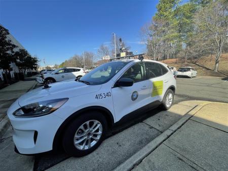
Beginning Tuesday, March 17, residents may notice City vehicles equipped with cameras and sensors driving along Alexandria streets as part of a pilot program to help the City better understand roadway conditions in real time and support proactive decision making on road safety and maintenance.
This SmartScan vehicle will hit the road with the SMART Roadway Management Initiative, a collaborative program between the City of Alexandria and the Virginia Tech Transportation Institute (VTTI) and funded through the U.S. Department of Transportation’s (USDOT) SMART Grant program.
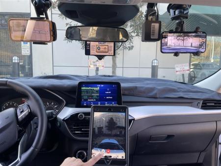
As part of the program, cameras and sensors mounted on and inside the vehicle will collect information about things like pavement condition, traffic signs, lane markings, and other transportation assets.
What residents need to know:
- The vehicle will be driven by a City staff member and is not autonomous.
- Cameras and sensors are used to collect infrastructure data only.
- Privacy protections are built into the system — faces, license plates, building interiors, and animals are automatically blurred.
- The data will help the City identify roadway issues faster and improve how streets are maintained and managed.
The pilot will also allow the City to test how this technology could help staff track roadway conditions, plan maintenance, and manage transportation assets more effectively in the future.
Learn more about the SMART Roadway Management Initiative at the project webpage.