Project Description: SMART Roadway Management
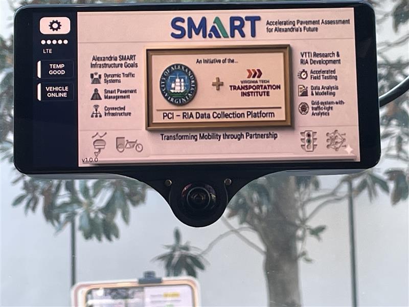
The SmartScan: SMART Roadway Management Initiative is a collaboration between the City of Alexandria and the Virginia Tech Transportation Institute (VTTI), funded through the U.S. Department of Transportation (USDOT) SMART Grant (Stage 1) program. The project leverages AI-enabled roadway assessment technologies to modernize how the City monitors pavement, signage, markings, and other critical transportation assets.
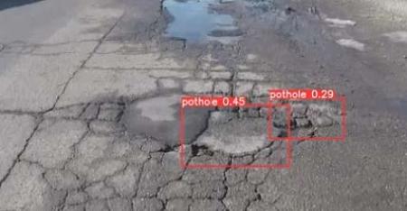
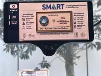
Through the use of cameras and sensors mounted on City or partner vehicles, SmartScan will collect real-time data on roadway conditions to create a continuously updated inventory of infrastructure assets. This information will support proactive, data-driven maintenance and investment decisions, helping the City extend asset life, improve safety, and reduce costs.
In partnership with VTTI, the project will pilot “Smart Detection” technology in the West End and Old Town Historic District, evaluating data accuracy, integration with City operational platforms, and scalability across the broader transportation network.
What's New!
SmartScan Vehicle Brings Real-Time Roadway Condition Data Collection to Alexandria Streets Starting March 17
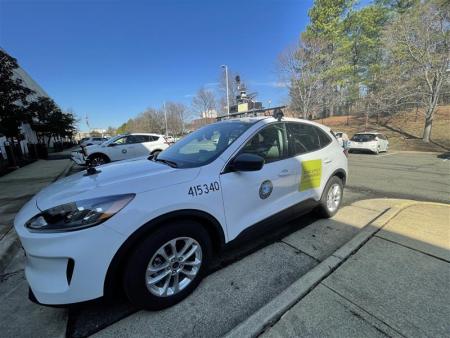
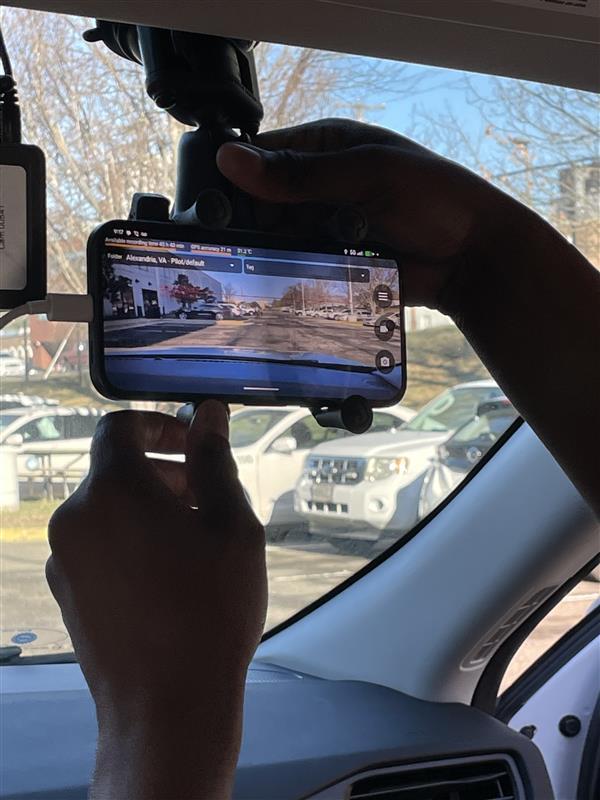
Beginning Tuesday, March 17, a City fleet vehicle equipped with SmartScan infrastructure scanning hardware will be on Alexandria streets collecting roadway data for an ongoing pilot program to modernize how the City monitors transportation infrastructure.
The vehicle will hit the road as part of the SMART Roadway Management Initiative, a collaborative program between the City of Alexandria and the Virginia Tech Transportation Institute (VTTI) and funded through Stage 1 of the U.S. Department of Transportation’s (USDOT) SMART Grant program.
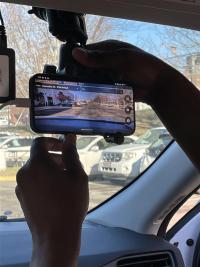
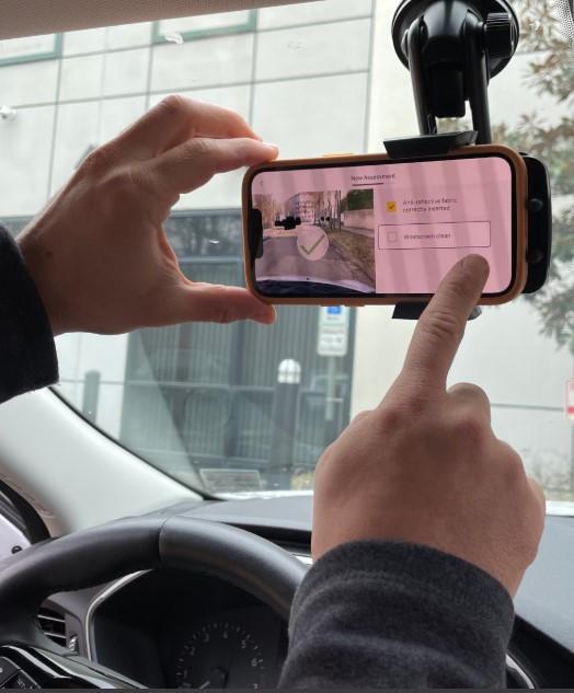
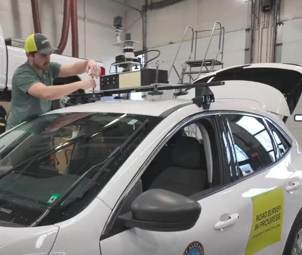
As part of the program, cameras and sensors mounted on the vehicle will collect real-time data on roadway conditions and catalog infrastructure assets. The SmartScan vehicle will pilot “Smart Detection” technology to help staff evaluate data accuracy, how data can be integrated with City operational platforms, and potential scalability across the broader transportation network.
All personal identification, building interiors, and even animals will be automatically blurred to protect privacy. While the sensors might resemble equipment on autonomous vehicles, the SmartScan vehicle is not autonomous and will be driven by a licensed City staff member at all times.
To mark the start of data collection work, the City's SmartScan vehicle was featured on the USDOT Research and Technology social media feed.
Project Status
The project officially launched in August 2025, marking the beginning of Phase 1 activities. During this stage, the team developed foundational materials including the Data Management Plan (DMP), Evaluation Plan, and a Request for Information (RFI) to identify potential technology vendors.
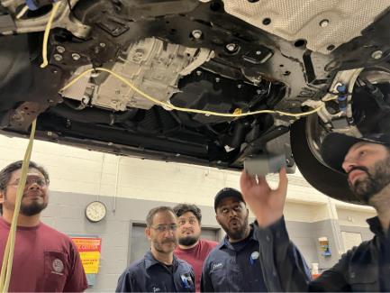
In February 2026, City staff from the Smart Mobility and Transportation Engineering teams, in coordination with the Fleet Management team, met with our four selected vendors to install infrastructure scanning hardware on a City fleet vehicle. This installation marks the next phase of the project as we prepare for deployment and testing as part of the City’s ongoing SmartScan implementation efforts.


Project Schedule
- Planning & Evaluation: FY 2025 – FY 2026
- Received and evaluated 24 CFI submissions (September 2026)
- Conducted evaluation and interviews (October 2025)
- Selected Vendors for Deployment
- Vaisala – Smartphone-based solution
- Vialytics – Smartphone-based solution
- Cyvl – Camera + LiDAR solution
- Roadway Management Technologies (RMT) – Camera + RADAR solution
- Deployment & Testing: Spring 2026
- Data Analysis: Spring - Summer 2026
- Reporting: Fall - Winter 2026/2027