Geography and Soils
Physiographic Provinces
The City is located in the Coastal Plain Physiographic province. The Atlantic Seaboard Fall Line, or ‘Fall Zone’, is the transition from the Piedmont to the west to the Coastal Plain. The Fall Zone is characterized by deeply entrenched stream valleys that commonly form gorges, cascades, and small waterfalls. In addition, fall line magnolia bogs can form along this physiographic boundary, including in Alexandria and neighboring Arlington.
Topography and Soils
Topography in the City of Alexandria varies, with an average elevation of 97 ft. above sea level, with ranges from -5 ft. along the waterfront to 287 ft. around Seminary Hill.
Bedrock geology is foundation for soil materials, and thus determines what soil types can be found at the regional and localized scale. Learn more about the soils in your backyard using the USDA-NRCS Web Soil Survey online.
Groundwater and Drainage Basins
Bedrock and its elevation can influence the locations of springs, seeps, and other points of groundwater discharge, and in turn these groundwater aquifers and discharge points can inform understanding of the underlying geology. Learn more about the City’s groundwater at the U.S. Geological Survey’s data portal.
Major drainage systems include Holmes Run, Strawberry Run, Taylor Run, Four Mile Run, Cameron Run, Backlick Run, and Hoof’s Run. These sub-watersheds feed into the Potomac River Basin and the Chesapeake Watershed. Learn more about City of Alexandria’s watersheds.
The Geologic Atlas of the City of Alexandria, Virginia and Vicinity
In 2016, Geologist Tony Fleming completed a several-year project to survey and map Alexandria’s geology and soils, the first comprehensive geologic survey for the City.
Welcome to the Geologic Atlas of the City of Alexandria. You can navigate directly to each of the maps, expanded explanations, and databases that make up the Atlas by clicking on the corresponding links below. If you are a first-time user or new to either the City or the science of geology, we recommend proceeding first to the brief overview of the Atlas, where you can learn about the various components of the Atlas and how to use them.
For the best resolution, you may want to open the plates in a different viewer, such as Adobe Acrobat, once they have loaded into your browser.
Geologic Maps and Expanded Explanations
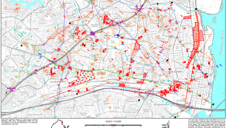
Plate 1
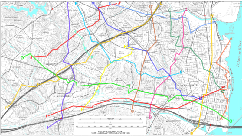
Plate 2: Geologic Cross Sections
Read the Expanded Explanation of Plates 1 and 2 to discover the geological data available in the City and how the maps and other parts of the Atlas were created. This document also explains geologic cross sections and how they illustrate the “third dimension” of Alexandria’s geologic architecture.
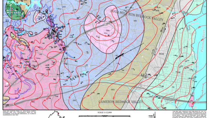
Plate 3
See the Map Showing Bedrock Geology, Topography of the Bedrock Surface, and Areas of Bedrock Exposure. Read the expanded explanation of Plate 3 to learn about the bedrock under the City, its history, where it is exposed, and why its buried topographic surface is so important.
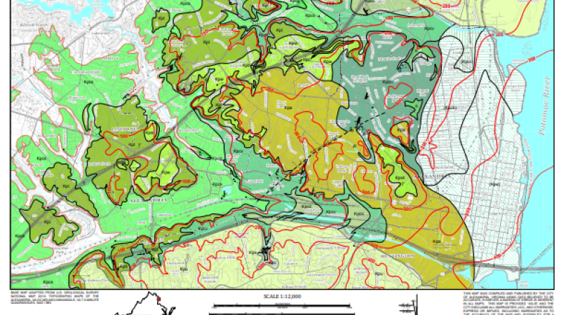
Plate 4
See the Geologic Map of the Potomac Formation. Read the expanded explanation of Plate 4 to learn about this formation of river deposits, which dates from the “Age of Dinosaurs” and makes up the great bulk of the geologic section beneath the City.
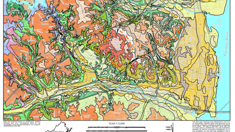
Plate 5
Explore the Geologic Map Showing Surficial Geology, Landforms & Major Areas of Artificially Modified Land. The expanded explanation of Plate 5 discusses the rocks and sediments at the surface across the City: their history, properties, and relationships to the major landforms.
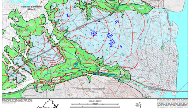
Plate 6
See the Map of the Piezometric Surface of the Cameron Valley Sand Member (lower aquifer) of the Potomac Formation and Other Aspects of Urban Hydrogeology. Read the expanded explanation of Plate 6 to learn about water in the City: streams, aquifers, wetlands, stormwater runoff, and more.
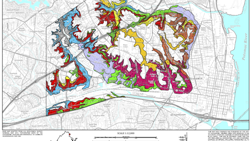
Plate 7
The Slope Stability Map shows which parts of the City are the most and least susceptible to landslides and expansive soils, and explains the factors behind those conditions.
Geologic Data
MS-Excel database of natural outcrops and excavations
MS-Excel database of geotechnical boring sites
MS-Excel database of historical wells catalogued by the USGS
Formation descriptions for five deep public water supply wells from the USGS historical collection
MS Excel database of the particle size and clay mineralogy samples analyzed and presented in the Atlas
Series of geologic fence diagrams generated from VDOT’s geotechnical boring database along the route of this major construction project
Simplified cross-section diagrams for most of the geotechnical boring sites in the database
Opens a glossary containing geological terms used in the Atlas
Full list of references, with links to downloadable publications