Project Description:
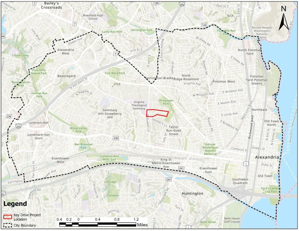
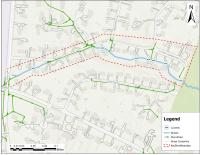
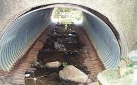
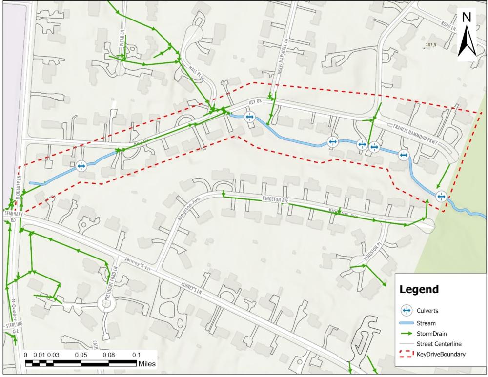
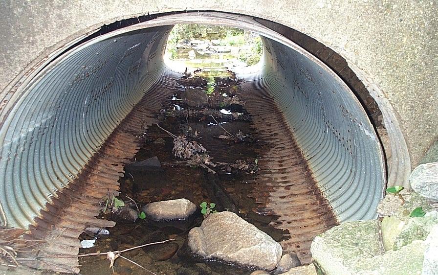
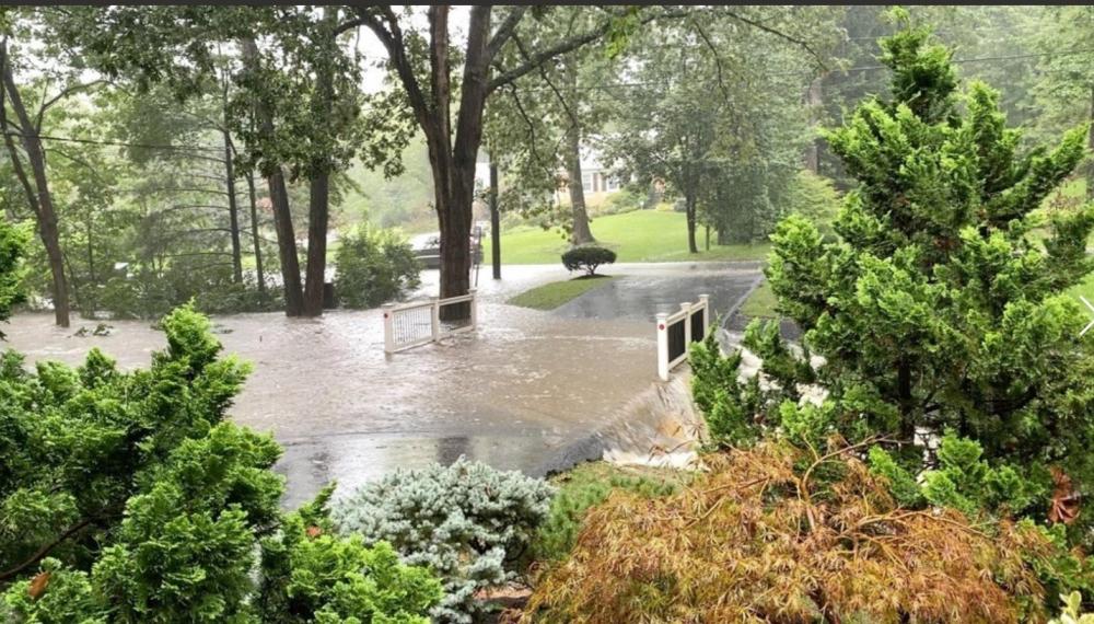
The Key Drive Flood Mitigation Project is a capital improvement project under Flood Action Alexandria aimed at reducing recurring flooding and improving the stability of the stream channel within a residential neighborhood along Key Drive and Francis Hammond Parkway. During moderate to heavy rainfall events, several existing culverts along the channel lack sufficient capacity to convey stormwater flows. As a result, water overflows the structures, backs up within the channel, and impacts nearby residential properties.
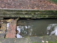
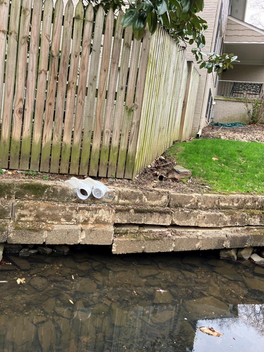
Over time, erosion and scour have deteriorated portions of the channel and undermined structural elements, increasing the risk of bank instability and damage to property. This project will evaluate existing conditions and develop improvements to increase culvert capacity and stabilize the channel. The goal is to reduce flood risk, protect nearby properties, and improve the long-term reliability and resilience of the stormwater system. Planning and design are expected to occur between 2026 and 2027, with construction anticipated in 2027–2028.
Sponsor Program:
Flood Action Alexandria
Sponsor Program Webpage:
(To be filled with program link)
Project Funding
Total Project Budget:
$2,6M
Planning:
$100k
Design:
$300k
Construction:
$2.2M (including contingency and CMI)
Funding Breakdown (optional), Funding Source
Local Stormwater Utility Fee Credit Program funding, with a federal grant application submitted to receive up to $2M towards the project.
Schedule
Planning:
Early 2026 – Mid 2026
Design:
Mid 2026 – Mid 2027
Construction:
Mid 2027 – Mid 2028
Planning Phase
Planning Overview
During the planning phase, City staff have completed initial field reviews and title research for properties along the Key Drive channel. This effort identified several locations where permanent stormwater easements will be required to construct and maintain the proposed improvements. The City has also performed a preliminary feasibility assessment, which confirmed that the existing culverts do not have sufficient capacity to convey storm flows and frequently overtop during heavy rainfall events, contributing to flooding and erosion along the channel.
As the planning phase concludes, the City is advancing comprehensive field surveys, easement coordination with affected property owners, utility coordination, and detailed hydrologic and hydraulic modeling to better understand stormwater runoff behavior throughout the corridor.
Based on this analysis, the City and its consultant will develop and compare potential improvement options, such as culvert capacity upgrades and channel stabilization measures. Each option will be evaluated for effectiveness, constructability, cost, and potential impacts to nearby properties.
The outcome of the planning phase will be a recommended improvement approach for the design phase that reduces flood risk, stabilizes the channel, and improves the long-term reliability of the stormwater system.
Planning Public Outreach
The City will coordinate with affected property owners throughout the planning and design process. Outreach may include neighborhood notifications, community meetings, and direct coordination with property owners where easements or construction access may be required. Feedback from residents will help inform the design and implementation of the project.
This project is part of the City’s ongoing stormwater capital improvement efforts to address localized flooding and aging infrastructure under the Flood Action Alexandria initiative.
Planning Initiative/Process:
Stormwater Capacity and Flood Mitigation Program
Planning Initiative/Process Webpage:
During the design phase, the City will work with the consultant to prepare detailed engineering plans for the selected alternative. This work will include final hydraulic modeling, channel and culvert design, utility coordination, environmental review, and preparation of construction drawings and specifications. The City will continue to coordinate with affected residents and agencies during this phase.
Construction is anticipated to begin in summer 2027 following completion of the design and permitting processes. The preferred design alternative may include culvert upgrades, channel stabilization, and replacement of undermined structures and its elements. Construction activities will be coordinated to minimize impacts to residents and maintain access to properties wherever possible.
Project Images