


Maps and Mobility Guides
Access our updated maps and mobility guides, available as downloadable and printable PDFs to help you navigate with confidence.
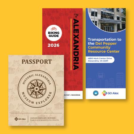
Discover the city’s museums with ease using this historic museum guide, featuring multiple modes of transportation and a fun reward for those who visit all eight locations!
To view or download the mobility guide, press here.
The Del Pepper Community Resource Center Guide connects residents to City services and programs.
To view or download the mobility guide, press here.
Explore the city on two wheels with the City Bike Map, featuring routes, trails, and helpful biking connections.
To view or download the City Bike Map, press here.
Air
Alexandria is served by all major domestic and international airlines at:
- Ronald Reagan Washington National Airport (5-10 minutes from Old Town)
- Washington Dulles International Airport (45 minutes from Old Town)
- Baltimore/Washington International Thurgood Marshall Airport (45 minutes from Old Town)
Rail
Amtrak
- The National Railroad Passenger Corporation (known as Amtrak), operates heavy rail service across the United States.
- Alexandria is served by its own Amtrak station (adjacent to the King Street Metrorail Station).
- For routes and reservations, visit amtrak.com or call 800-USA-RAIL.
Metrorail
- Metrorail is a subway system operated by the Washington Metropolitan Area Transit Authority (WMATA), known as Metro.
- Alexandria has five Metrorail stations:
- Braddock Road (Yellow Line and Blue Line)
- Eisenhower Avenue (Yellow Line)
- King St-Old Town (Yellow Line and Blue Line)
- Van Dorn Street (Blue Line).
- Potomac Yard (Yellow Line and Blue Line)
- When traveling late at night, be sure to check the scheduled departure time for the last train. At many stations, the last train departs before system closing time, so it is important that you allow enough time to enter the system and board the train. Last train departure times are posted at each station kiosk.
- Metrorail system maps are available in a variety of formats. To create a personalized trip plan, use Metro's Trip Planner.
- Fare information, including Reduced Fare Options (Senior SmarTrip and Metro Lift)
Virginia Railway Express
- Virginia Railway Express (VRE) offers commuter rail service from the suburbs of Northern Virginia to downtown Washington, D.C.
- Alexandria is served by its own VRE station (adjacent to the King Street Metrorail Station), which is on VRE's Manassas Line and Fredericksburg Line.
- For schedule information, visit vre.org or call 800-RIDE-VRE.
Bus
DASH
- DASH is the local bus service operated by the Alexandria Transit Company.
- For schedule and route information, visit dashbus.com or call 703-746-DASH.
King Street Trolley
- For information on the Free King Street Trolley please click HERE
Metrobus
- Metrobus is the regional bus service operated by the Washington Metropolitan Area Transit Authority (WMATA), known as Metro.
- Alexandria is served by many Metrobus routes, and hours vary. Metrorail system maps are available in a variety of formats. To create a personalized trip plan, use Metro's Trip Planner or call 202-637-7000.
Driving
Highway
- Alexandria is conveniently located along I-95, I-495, I-395, Rt. 1, Rt. 7, Rt. 236, and the George Washington Memorial Parkway, and is minutes from I-66 and I-295.
- For current road conditions, including alerts and traffic cameras, see the Virginia Department of Transportation or call 5-1-1.
- Learn about ridesharing in Alexandria
- Learn about HOV Lane restrictions in Alexandria and around the region
Biking/Walking
- Bicycling in Alexandria
- Dockless Mobility (Scooters)
- Multi-Use Trails in Alexandria
More Information
For more information on getting around Alexandria, including assistance with trip planning, visit alexandriava.gov/GOAlex.