Project Overview
The City of Alexandria was awarded funding from the Northern Virginia Transportation Authority (NVTA) to design and construct improvements to the South Van Dorn Street bridges to better accommodate people walking and biking. Those improvements are a core part of this project to improve safety, comfort, and connectivity for the users of the planned improvements. This work will also coordinate with nearby projects, including the West End Transitway and planned intersection upgrades at Eisenhower Avenue.
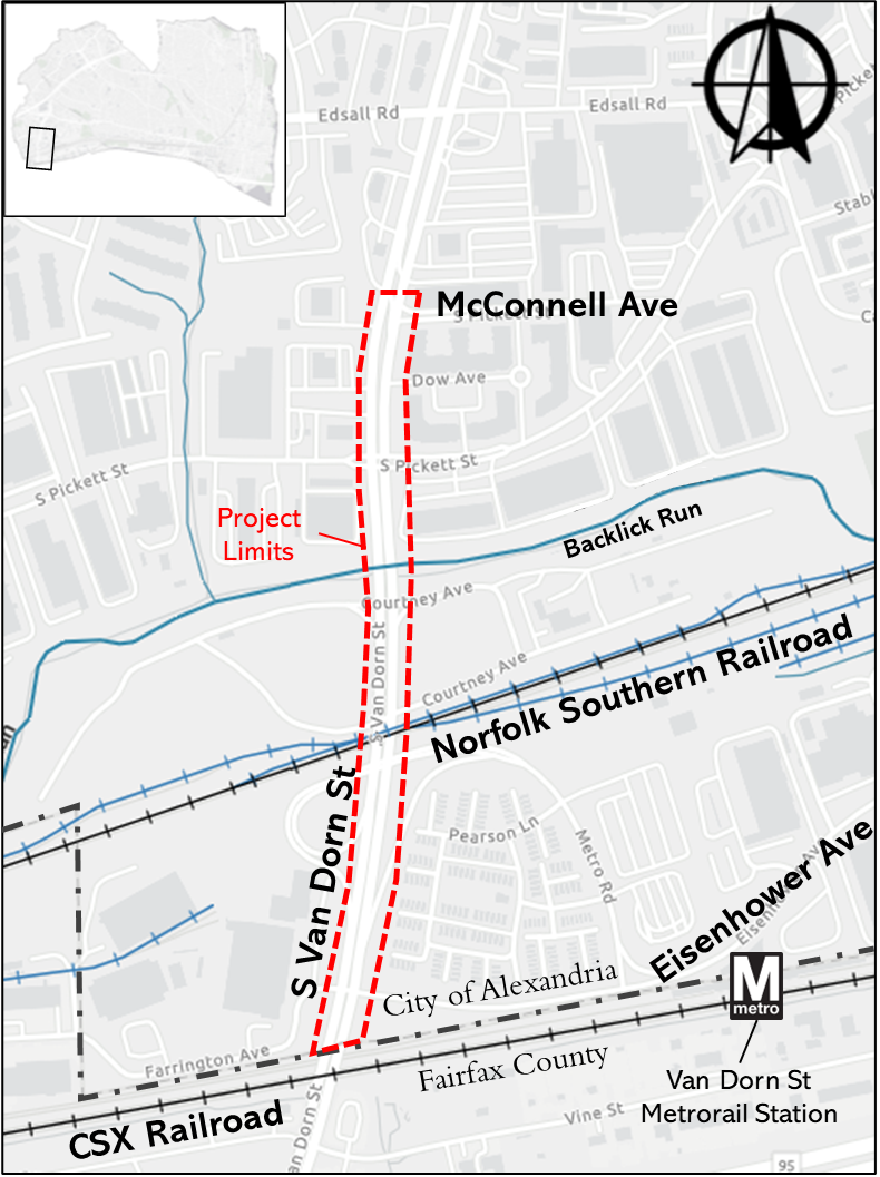
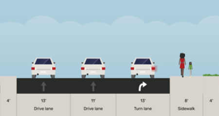
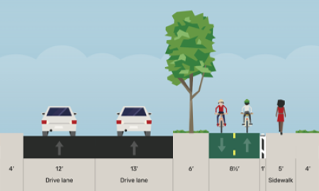
Existing Conditions and Proposed Concepts
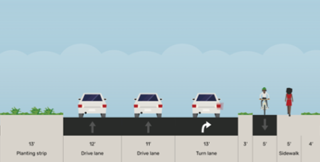
As an initial phase of this project, the City developed three concepts in consideration of pedestrian and bicyclist comfort, alignment with the City's vision, risks, and project costs. Below are high-level descriptions of existing conditions as well as each concept. (Note: cross sections shown below represent the section of Van Dorn Street just north of Eisenhower Avenue)
Note that the concepts were divided into four segments, providing an opportunity to mix-and-match concepts for a preferred alternative.
A link to more-detailed information, including benefits and challenges of each concept by segment, can be found here.
Existing Conditions
Combined space for bicycles and pedestrians, primarily 8 to 10 feet wide (12 feet in segment 4), and located directly adjacent to the vehicle travel lanes.
Concept 1:
Maximizes separate travel spaces for bicycles (cycle track) and pedestrians (sidewalk) in all segments and provides a buffer between the cycle track and the vehicle travel lanes (either a planting strip with trees or vertical barrier). This concept includes the closure of the access ramp to Metro Road and has the highest associated cost.
CONCEPT 2:
Balances separate travel spaces for bicycles and pedestrians in all segments considering construction impacts. This is accomplished with a narrower cycle track, narrower sidewalk, and/or narrower buffer. This concept retains access to Metro Road with a modified design and is less costly than Concept 1.
CONCEPT 3:
Provides separate travel spaces for bicycles and pedestrians where space permits. Where unavailable, a shared use path is provided for bicyclists and pedestrians to travel in the same space (segment 1 and segment 3). This concept retains access to Metro Road in the current configuration and has the lowest associated cost.
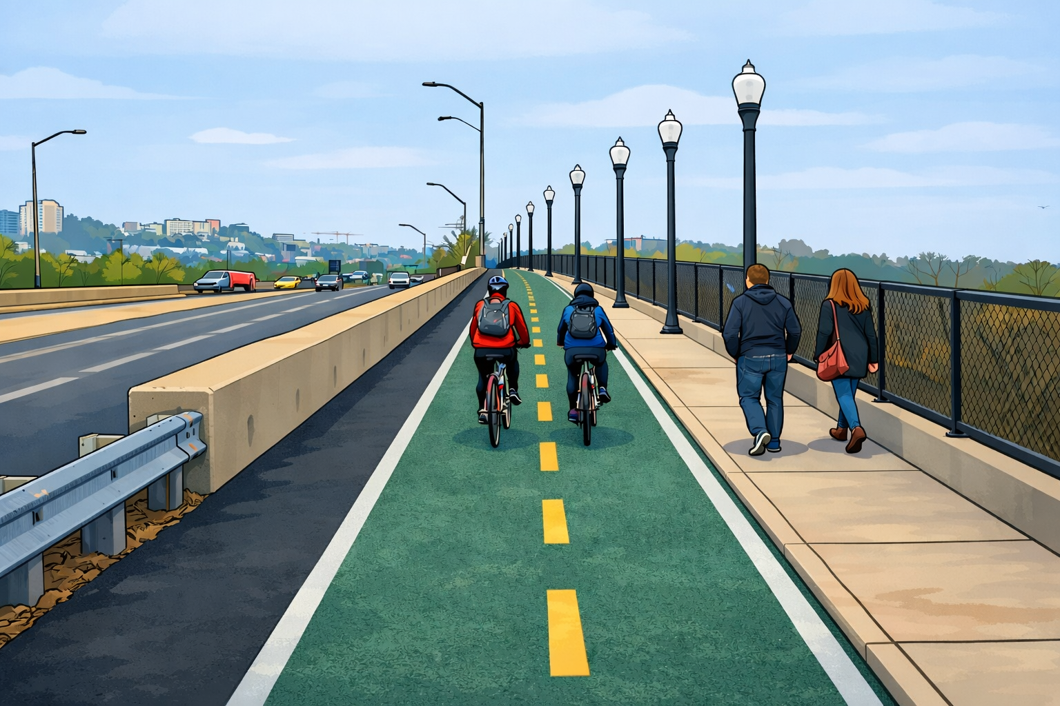
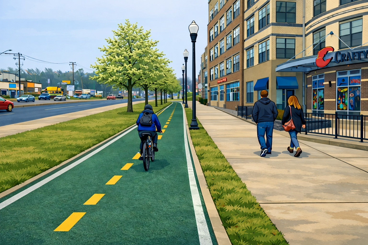
Below are graphical renderings of a potentional configuration of the crossing of the Norfolk Southern Railroad in Concepts 2 and 3 as well as a potential rendering of Concept 1 just north of South Pickett Street.
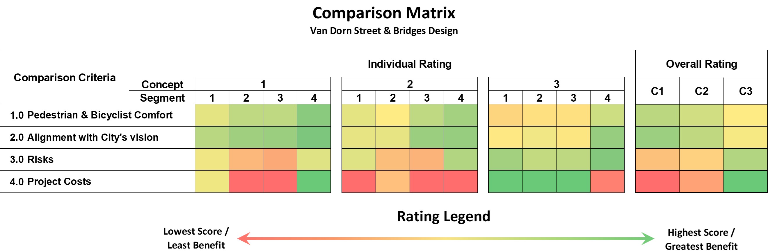
Provided below is the scoring of each concept by segment considering the elements noted above along with an overall rating.
Project Schedule
Community Engagement: Ongoing
- Project feedback form closed on April 16, 2026. A summary of the feedback received from 178 responses from the community can be found here.
- A preferred alternative was developed based on community feedback, available funding, construction feasibility, data, engineering best practices, and adopted City plans and polices. Key features of the concept:
- Maintains vehicular access to Metro Road from S Van Dorn Street
- Widens space for people walking and biking along the east side of S Van Dorn Street
- Provides vertical separation between walking and biking space over Backlick Run
- Retains all travel lanes along S Van Dorn Street
- Maximizes the preservation of existing trees
An illustration of the preferred alternative can be viewed here.
Planning & Conceptual Design: 2025-2026
- See design ideas here.