Project Description: Smart Mobility Lab (SML)

The Smart Mobility Lab (SML) is a collaborative initiative between the City of Alexandria and the Virginia Tech Transportation Institute (VTTI) aimed at enhancing transportation efficiency, safety, and sustainability through advanced technologies and data-driven solutions.
The project is organized into four core phases: technology deployment, workforce development, student engagement, and stakeholder collaboration, designed to strengthen Alexandria’s position as a regional leader in smart mobility innovation.
The SML initiative will deploy and integrate AI-enabled traffic technologies, establish a workforce development program, and create a secure data exchange platform to facilitate research, education, and applied innovation. This effort supports Alexandria’s broader Digital Mobility Ecosystem vision, promoting equitable, data-informed decision-making and advancing next-generation transportation infrastructure.
What's New!
Signal Optimization & Data Workshop
The Smart Mobility Lab has put together a comprehensive workshop program focused on past, present, and future of signalized intersections. We hope you can join and feel free to invite others in your network to take part.
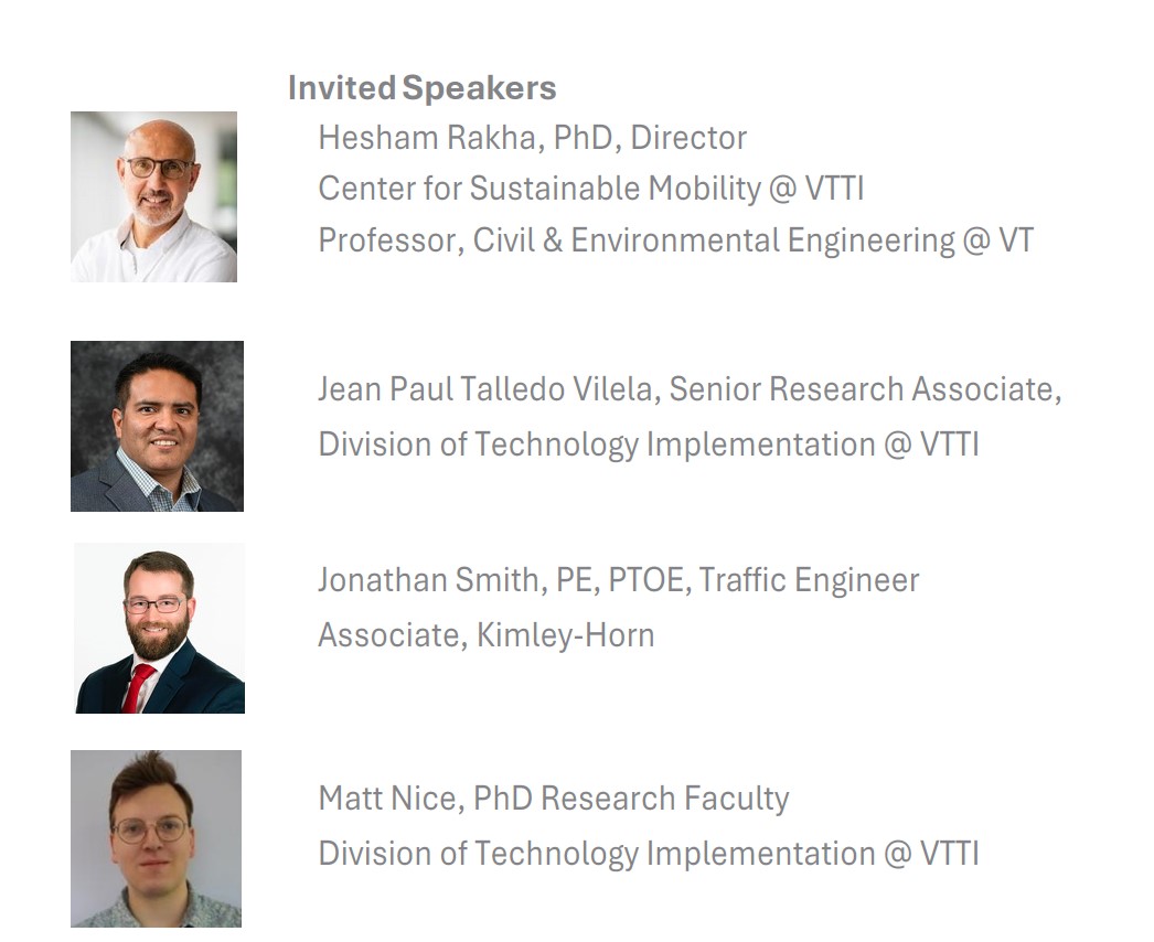
Please join us on Wednesday, April 8th from 8:30am-2:30pm in Classroom 4100 at Academic Building One in Alexandria, where we are hosting a Signal Optimization & Data Workshop. Next generation technology has arrived at intersections in Northern Virginia, and it’s poised to expand. Distinguished speakers from the Virginia Tech Transportation Institute (VTTI) and Kimley-Horn will cover the algorithms, the hardware, and the data that define these control systems, which have a major effect on traffic and safety. What are the algorithms we use now, and what are the cost/benefits of changing? What performance metrics should we pay attention to? What implications are there for safety and traffic flow? These questions and more will be discussed.
This event may be particularly relevant for urban planners, transportation engineers, faculty researchers, graduate students, transportation-related government employees, and others who are interested in the intersection of applied research, computing, and transportation.
Please register on our event page
Project Goal:
The project is active and progressing toward completion of its deployment and educational objectives. The team has conducted multiple rounds of coordination between VTTI and the City of Alexandria to finalize procurement, integration, and evaluation of Smart Mobility Lab technologies at key intersections.
Workforce and student engagement components are underway, with graduate-level students participating in applied research projects leveraging SML data and infrastructure. Three additional educational workshops on smart mobility are being developed for municipal employees, students, and industry stakeholders.
Development of the data exchange software platform is in progress, with validation and security testing scheduled to ensure controlled access and interoperability between academic and City systems. Ongoing biweekly project management meetings ensure alignment across City departments and partner organizations.
A 12-month extension to the project’s period of performance has been requested to support completion of remaining integration, training, and community engagement tasks. The revised end date is September 30, 2026.
Project Scope
The Smart Mobility Lab is a partnership between the City of Alexandria and the Virginia Tech Transportation Institute that is installing smart traffic technology at key intersections to collect and share real-time transportation data. The project also includes building a simple, user-friendly AI tool that helps City staff quickly understand traffic information and make informed decisions without needing technical expertise. In addition, the initiative provides hands-on learning for students and training for City staff, while ensuring the technology is smoothly integrated into daily operations and continuously evaluated for performance.
Project Timeline
Planning and Design: 2023 to 2024
Deployment and Integration: 2024 to 2026
Workforce and Student Programs: 2024 to 2026
Evaluation and Reporting: Through September 2026
2026 Virginia Tech STEM Fair
February 2026, our Smart Mobility Team partnered with Virginia Tech Transportation Institute to showcase our Smart Mobility Lab project at the 2026 Virginia Tech STEM Fair.
We connected with K–12 students, educators, and families to provide a high-level overview of the SML program, demonstrating how our roadway cameras capture traffic data and how we leverage that information to support data-driven transportation decision making. This outreach directly supports our student engagement efforts under our NIST grant, helping introduce the next generation to real-world applications of technology, data analytics, and smart city innovation.

Project Budget
Source: Federally funded through National Institute of Standards and Technology (NIST)
Budget: $900,000