Project Description & Area
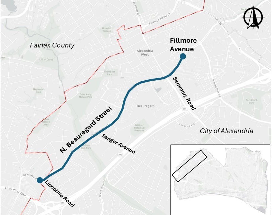
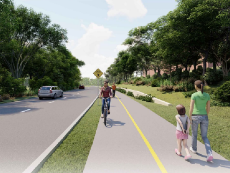
Building from recommendations in the Alexandria Mobility Plan and AlexWest Small Area Plan, the City is undertaking a feasibility study to extend the Beauregard Trail from it's current terminus at Fillmore Avenue to the western Alexandria boundary with Fairfax County. This approximately 1.5 mile stretch of North Beauregard Street is four-lanes wide and connects high-density residential neighborhoods, employment centers, transit centers, parks, retail and commercial uses, and a variety of schools including Northern Virginia Community College, Ferdinand T. Day Elementary School and William Ramsey Elementary School. By providing consistent and safe bicycle and pedestrian infrastructure where it is currently limited or nonexistent, the City can provide greater connectivity and access for all residents.
By developing a feasible concept that envisions improved infrastructure, the City can leverage future grant funding for the full design and implementation of the trail.
Project Materials
July 2026, Project Fact Sheet
The initial project study has been completed and project fact sheets are available in English, Spanish, Arabic and Amharic.
- Project Summary Sheet(English)
- Project Summary Sheet (Spanish)
- Project Summary Sheet (Arabic)
- Project Summary Sheet (Amharic)
May 18, 2026 Presentation to the Traffic and Parking Board
City Staff presented an overview of the project study and potential next steps for additional study of the corridor. Review the presentation and recording of the presentation at the links below:
- Link to Recorded Presentation (See time stamp 2:11 for start of recording)
- Link to Presentation (See slide 39 for start of presentation)
March 25, 2026 Virtual Meeting
The City developed three potential designs for the Beauregard Trail and will continue to assess the feasibility of the designs. Information about the project, including the project scope, existing conditions and potential design options are included in the recorded presentation below.
- Link to Recorded Presentation (Recorded from a virtual community meeting on March 25, 2026)
- Copy of Presentation (English)
- Copy of Presentation (Spanish)
About the Alexandria West Planning Process
Between 2022 and 2024, the City of Alexandria undertook a plan update to the Alexandria West chapter of the Master Plan and approved the AlexWest Small Area Plan in November, 2024. The City utilized a variety of in-person and online strategies to engage with the community, including meetings and pop-ups in multiple languages at a variety of times and locations throughout the Plan area. With this approach, all members of the community were invited to participate, discuss, and collaborate on a shared vision for the future by engaging in a range of options that worked best for them. The updated Small Area Plan presents a community-driven vision for an inclusive, diverse, vibrant community with recommendations to guide future development and growth in the community.
Beauregard Trail Feasibility Study Related Projects
Frequently Asked Questions
Starting in early 2026, city staff and the design team will assess current conditions, needs and opportunities to develop design concepts which could provide improved connectivity and safety for pedestrians and cyclists along N. Beauregard Street. In spring 2026, the city will undertake community engagement and seek community input on the various options before selecting a preferred concept for the trail design. There is no timeline for full design or construction as the city will have to seek funding to advance the project.
North Beauregard Street connects a number of key community centers, high-density employment centers, schools, retail, parks and open space and is a critical north-south connector for the community. However, the current design prioritizes vehicles and provides limited and inconsistent connections for pedestrians and cyclists. By developing a concept plan to improve pedestrian and cyclist infrastructure the City can be more competitive when seeking grant funding for full design and construction, increasing our odds of receiving future funding. And by improving pedestrian and bicycle infrastructure, we create a community which provides safer and more equitable access for a variety of users.
No, this project is limited to a feasibility study to see if there is enough space on or next to North Beauregard Street to install future sidewalks and bike lanes. And if there is enough space, what do those sidewalks and bicycle lanes look like and how do they connect to existing infrastructure. Once a high-level design is developed, the City can apply for design and construction grants.
Questions?
For additional information, please contact Sara Brandt-Vorel, Transportation Capital Project Manager, at sara.brandtvorel@alexandriava.gov