
Point Lumley Park Improvements
The following images are artist renderings depicting proposed improvements to Point Lumley Park as of Spring 2025. The renderings and design concepts presented are currently under development, for conceptual reference only, and subject to change and design progresses. Additional information about current conditions and proposed design elements can be found in the sections below.
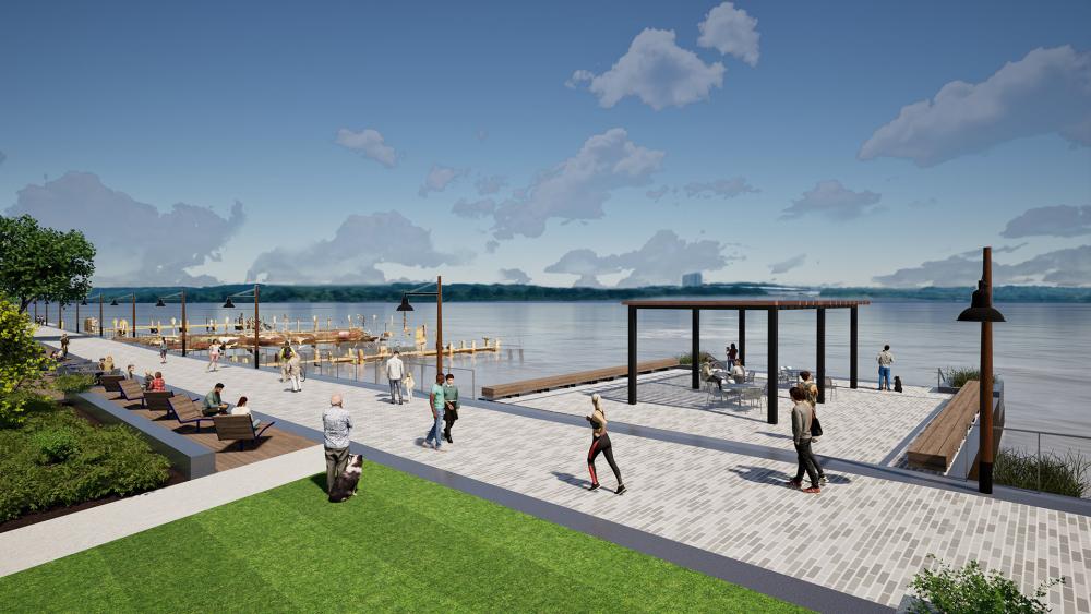


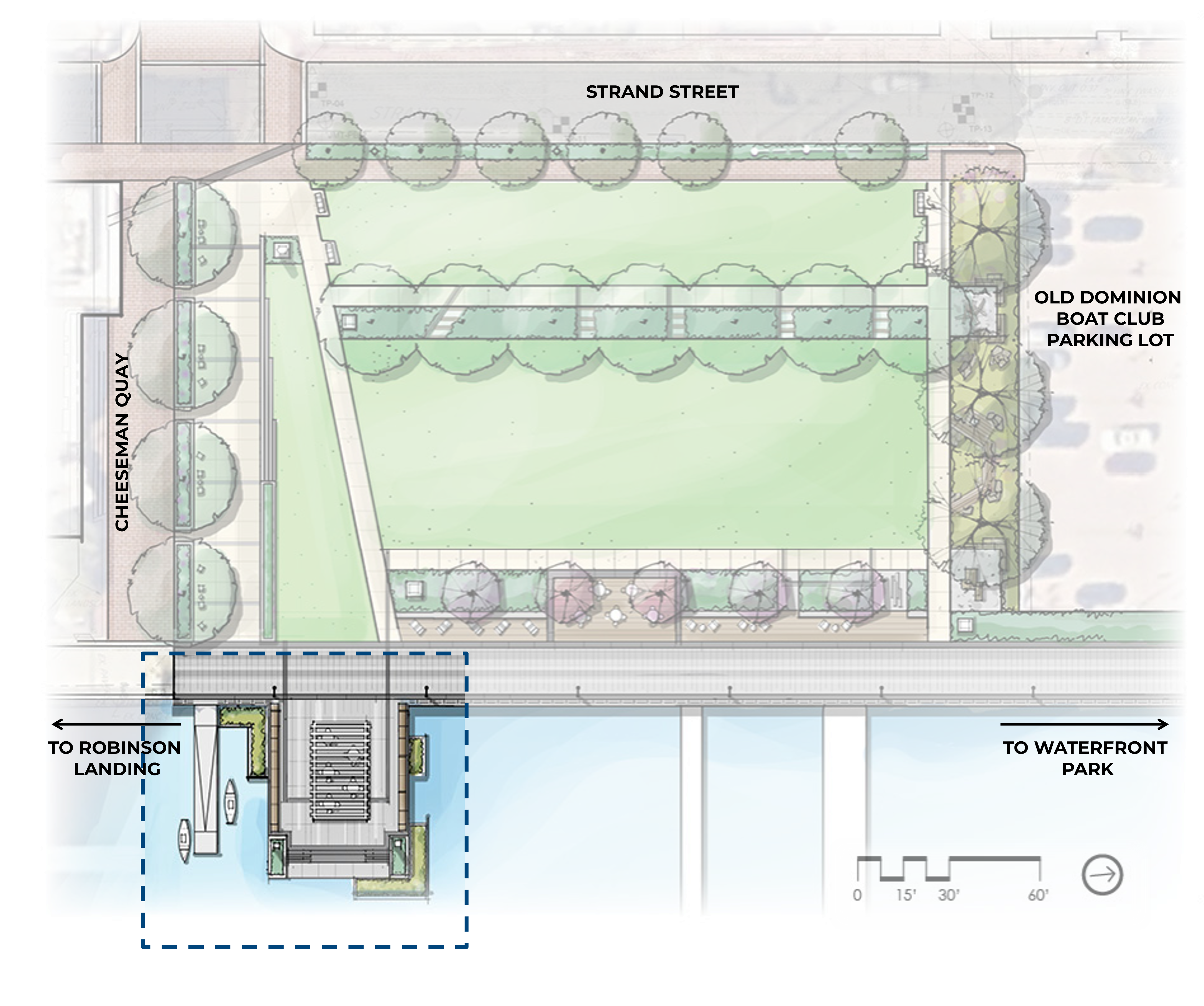
Looking East from the River Gateway/Shipbuilding Walk to the Promenade and Wharf
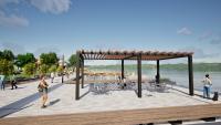
Looking West from the Wharf through the Shade Structure into Point Lumley Park

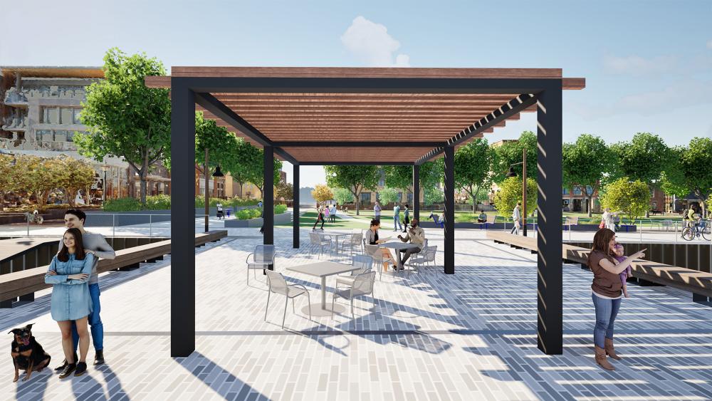
Looking North at the Promenade and River from the Wharf through the Shade Structure.
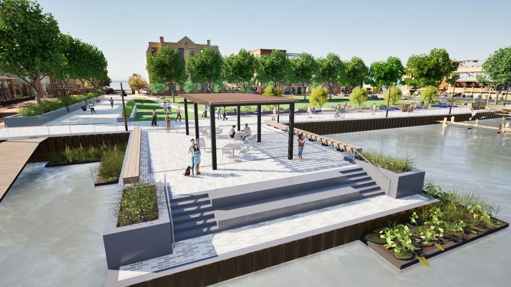
Looking West at the Wharf, Shade Structure, Promenade, and Point Lumley Park, from an Elevated View
Existing Conditions
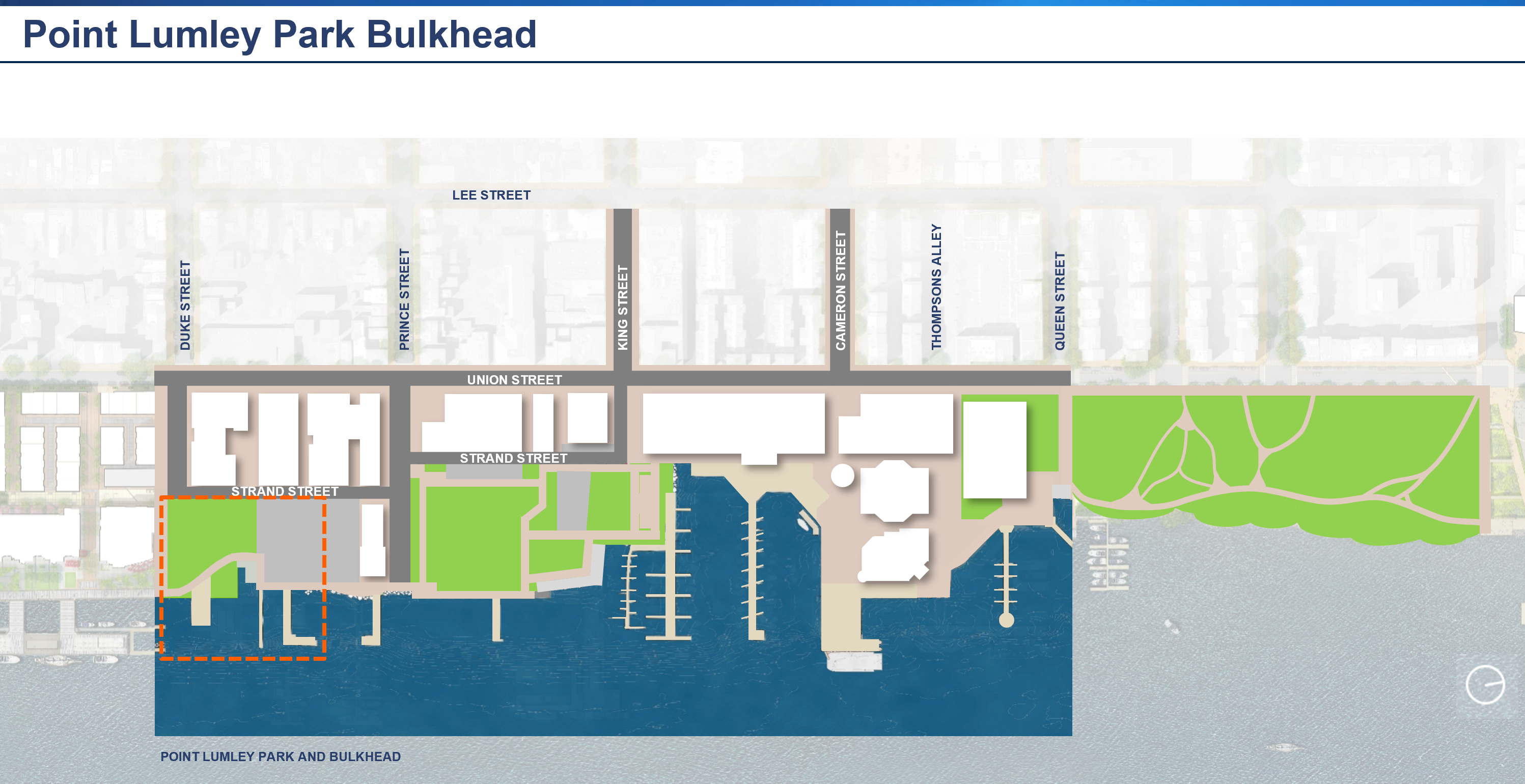
Site Location
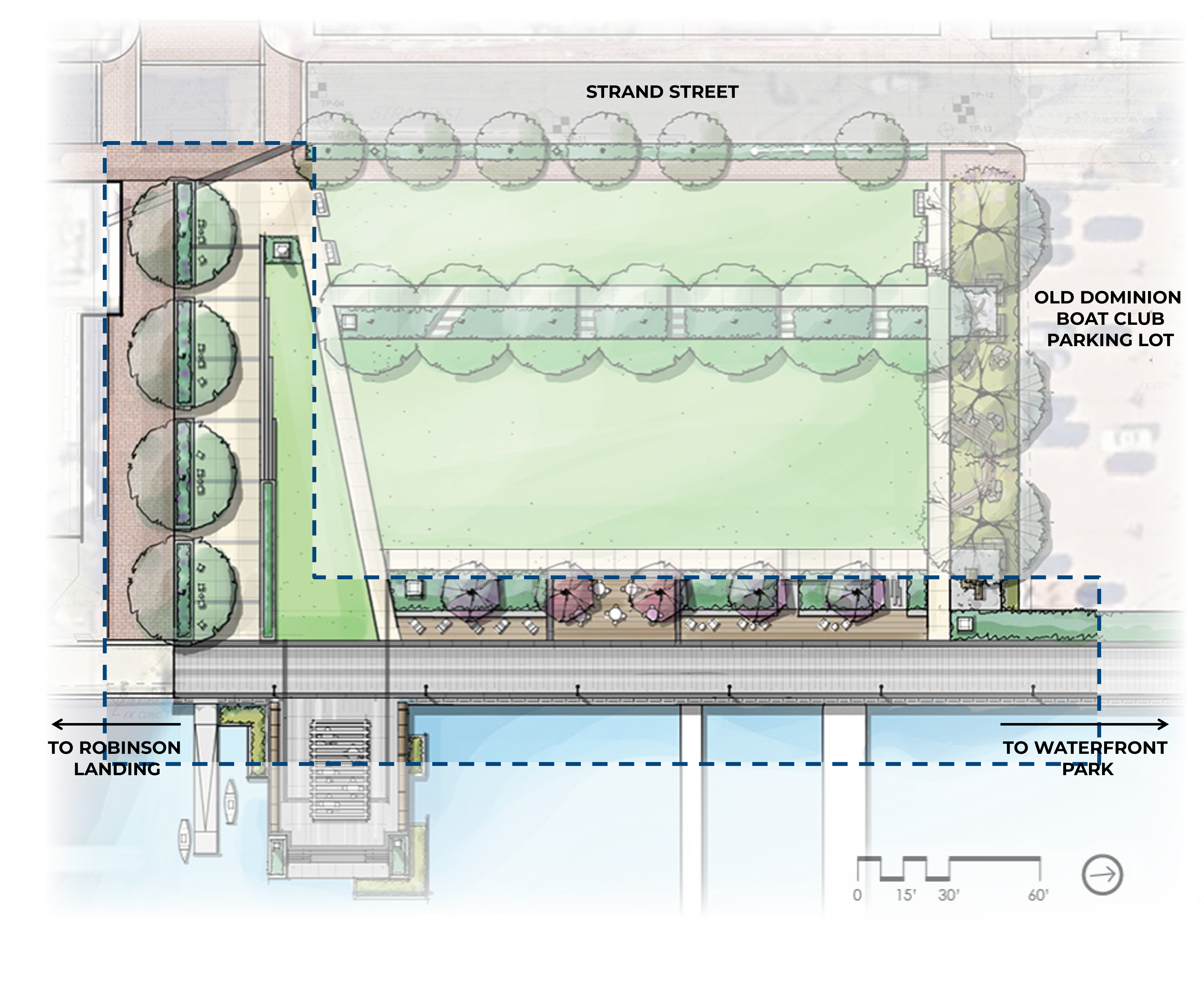
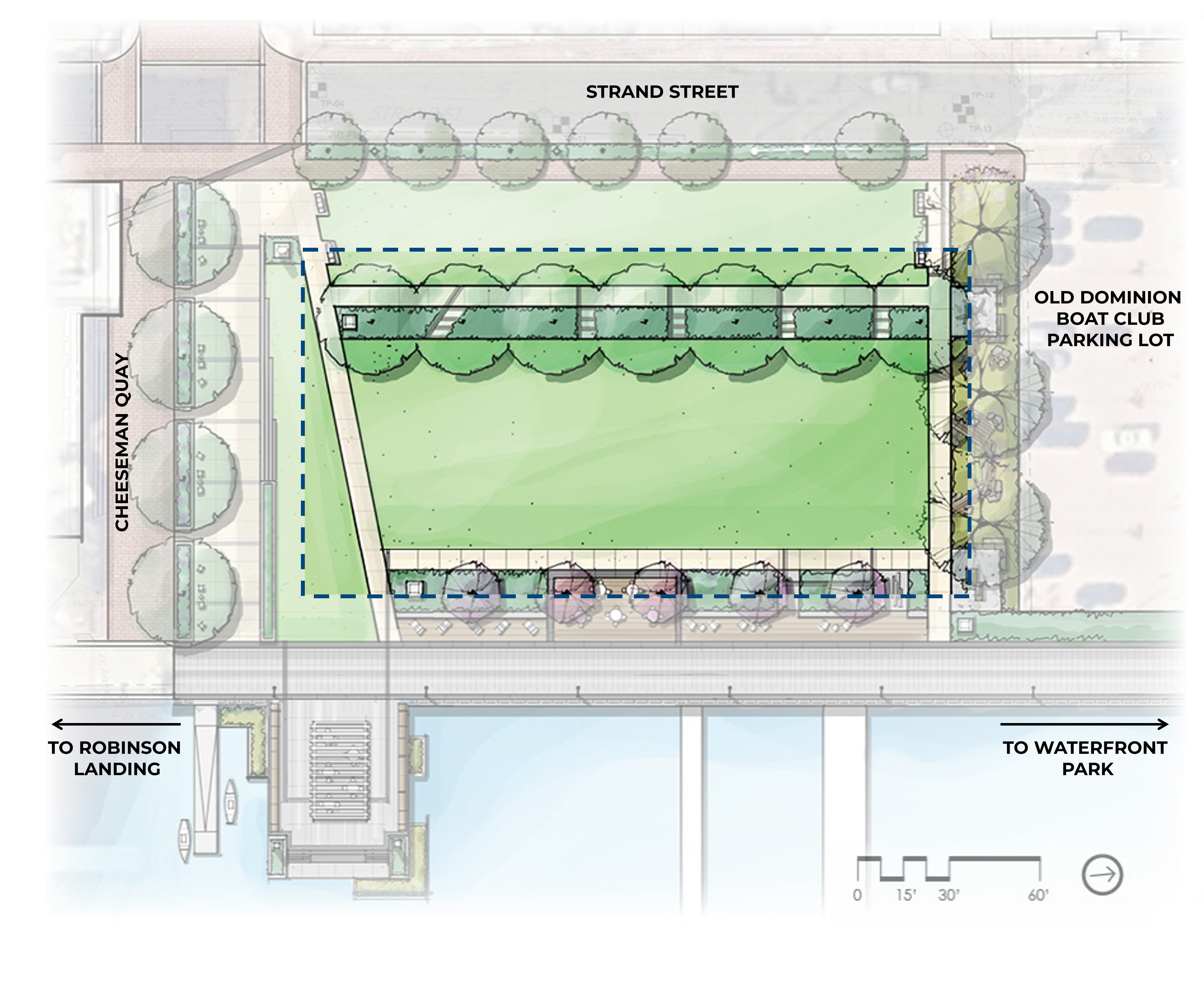
Point Lumley Park is located at the northeast corner of Duke Street and Strand Street. Point Lumley Park is currently bordered by the Robinson Landing development to the south and the Strand Parking Lot to the north. The project proposes to remediate and convert the Strand Parking Lot into park land. If constructed, Point Lumley Park would share a northern boundary with the Old Dominion Boat Club parking lot.
Site History
When Alexandria was founded in 1749, the area currently designated as Point Lumley Park was marshland associated with a bay of water bounded by Point Lumley to the south and Point West to the north. This area soon came to be infilled and populated by warehouses and industrial buildings, including Pioneer Mill, which burned down in an 1897 fire. By the late 1950s, most warehouses in the area were infilled and the shoreline continued to evolve until the mid-1990s. The final structure was torn down in 2018 and current park conditions were established.
Learn more about the history of Alexandria’s Waterfront:
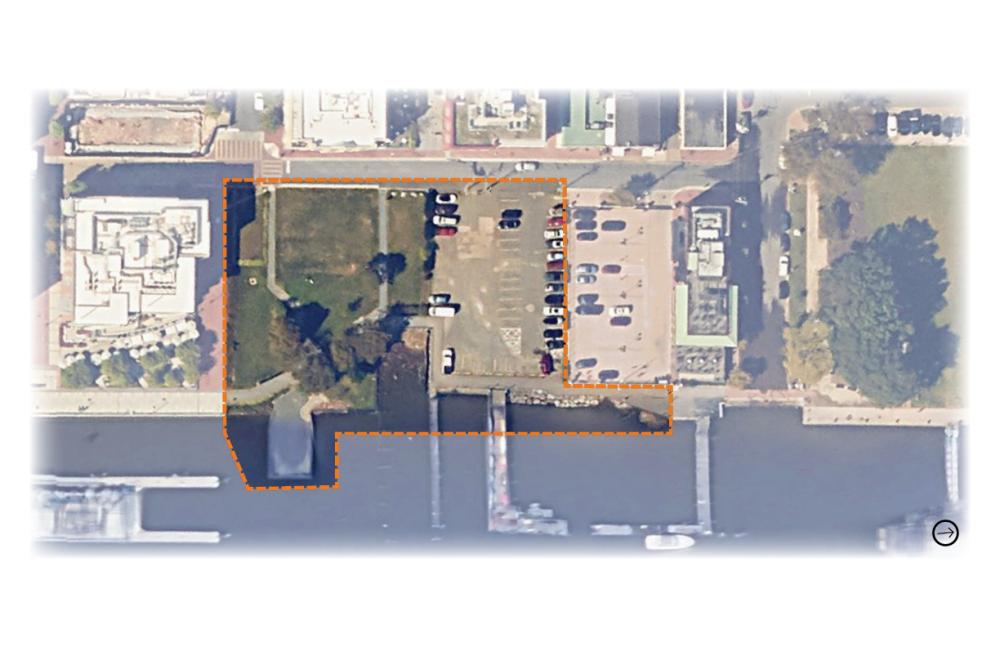
Birds-eye view of Point Lumley Park and the Strand Parking lot as of 2025. The proposed future Point Lumley Park extents are marked with an orange dashed line.
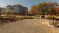
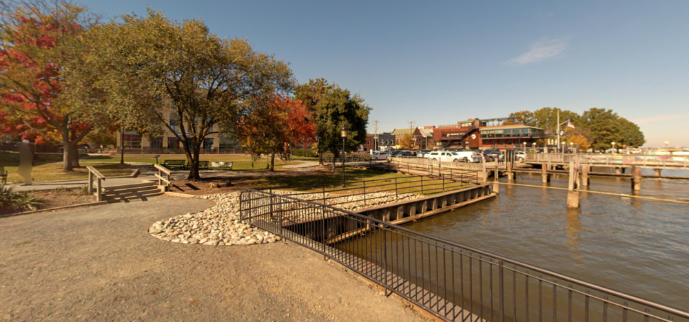
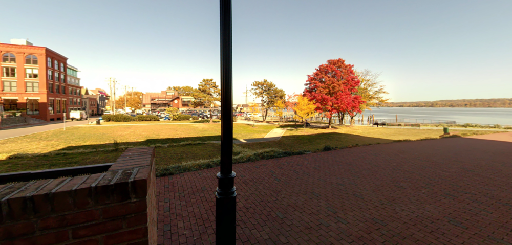
Street-level view of southern Point Lumley Park and Robinson Landing from the existing wharf.
Street-level view of northern Point Lumley Park, the Strand parking lot, Old Dominion Boat Club parking lot, and Old Dominion Boat Club building, from the existing wharf.
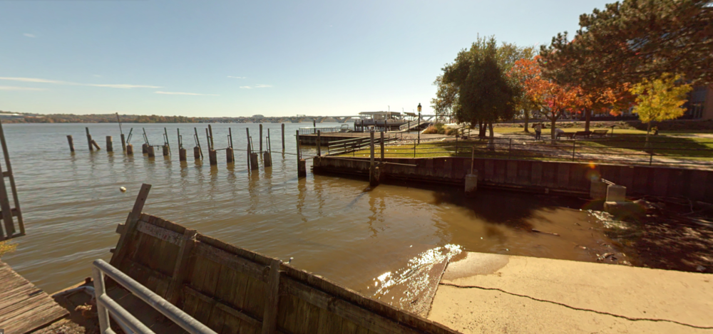
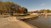
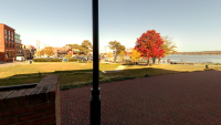
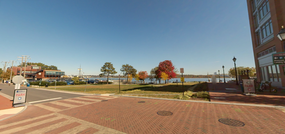
Street-level view of the southern Point Lumley Park shoreline and wharf from the promenade at the foot of the Strand parking lot.
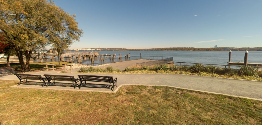
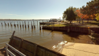
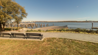
Street-level view of the Point Lumley Park wharf and Potomac River from the southern park lawn.
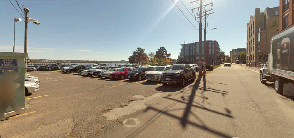
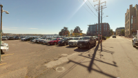
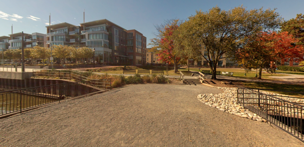
Street-level view of the Strand parking lot, Point Lumley Park, and Robinson Landing, looking south from Strand Street at the Old Dominion Boat Club parking lot property line.
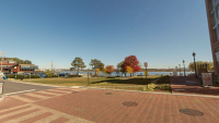
Street-level view of Point Lumley Park and the Strand parking lot, looking east from the intersection of Strand Street and Duke Street.
Street-level view of Point Lumley Park, the Strand parking lot, Old Dominion Boat Club parking lot, and Old Dominion Boat Club building, looking north from Cheeseman Quay and Robinson Landing.
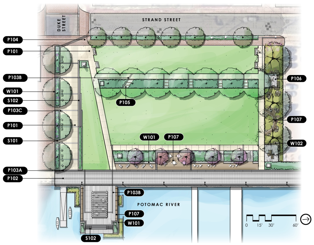
Proposed Plan
Design Theme
Point Lumley Park will be a celebration of Alexandria’s maritime history.
Following Alexandria’s founding in 1749, a process known as “banking out” was used to create a new, man-made deep-water shoreline that could accommodate the docking of large vessels. This access to the Potomac River forged a trade gateway that would shape Alexandria’s economy and cultural identity, connecting the town with the world.
Point Lumley Park will honor this story of connection between land, water, and history in immersive and creative ways, from an engaging walkway that recounts its shipbuilding and maritime history to playful furnishings inspired by wharf and ship construction.
Design Goals
The design of Point Lumley Park is seeks to:
- Integrate the park with the greater City and historic context
- Maximize spatial flexibility for programming and events
- Reinforce connections to the Potomac River and the greater waterfront
Spring 2025 Design Update
During the FY 2026 budget approval process in Spring 2025, Alexandria City Council approved the additional project funding necessary to address vital Waterfront bulkhead repairs. This funding is enabling the City's design team to pursue the technically-preferred design for Point Lumley Park, which includes a robust continuous bulkhead and promenade extending from Robinson Landing in the south to the northeastern edge of King Street Park in the north. Information about the previous Cost-based Designs can be found in the Point Lumley Park History section below.
*All designs are drafts, deliberative, and pre-decisional.

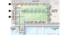
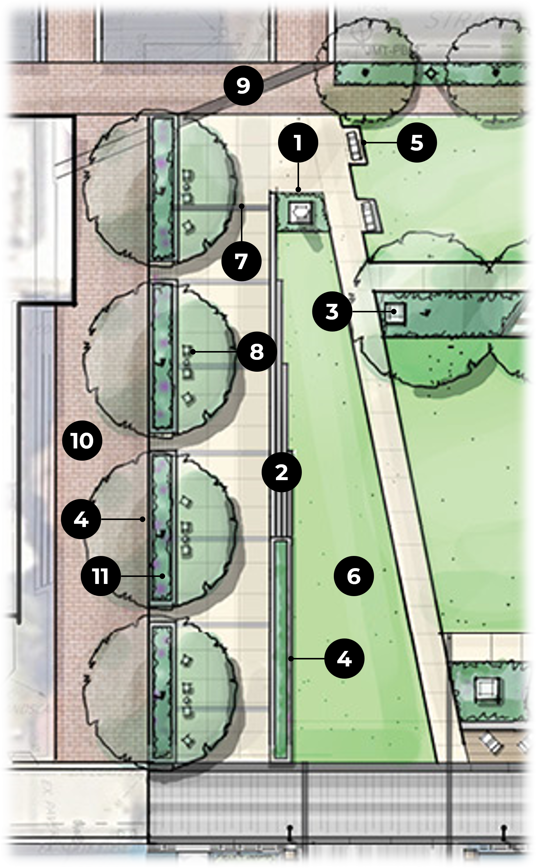
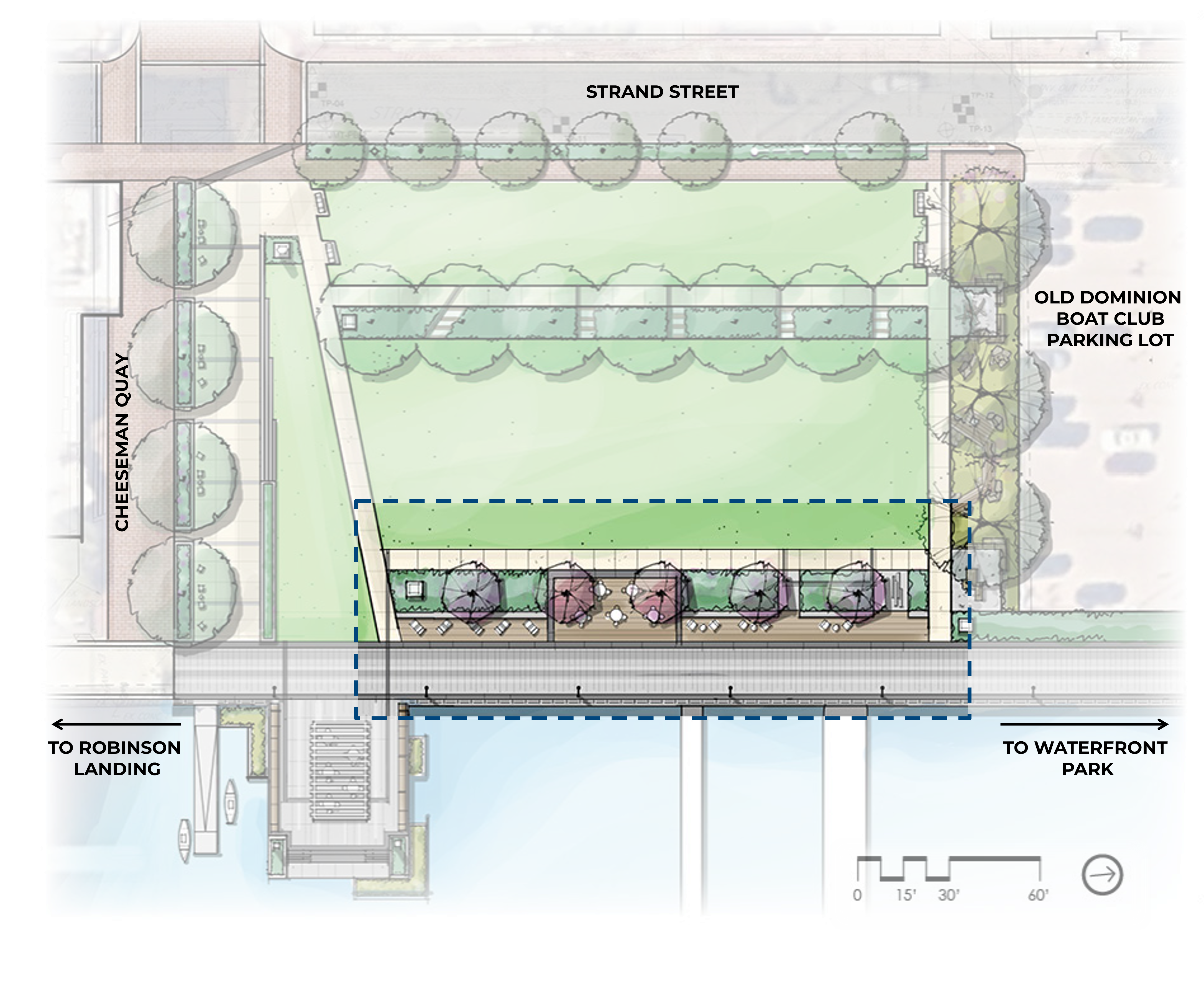
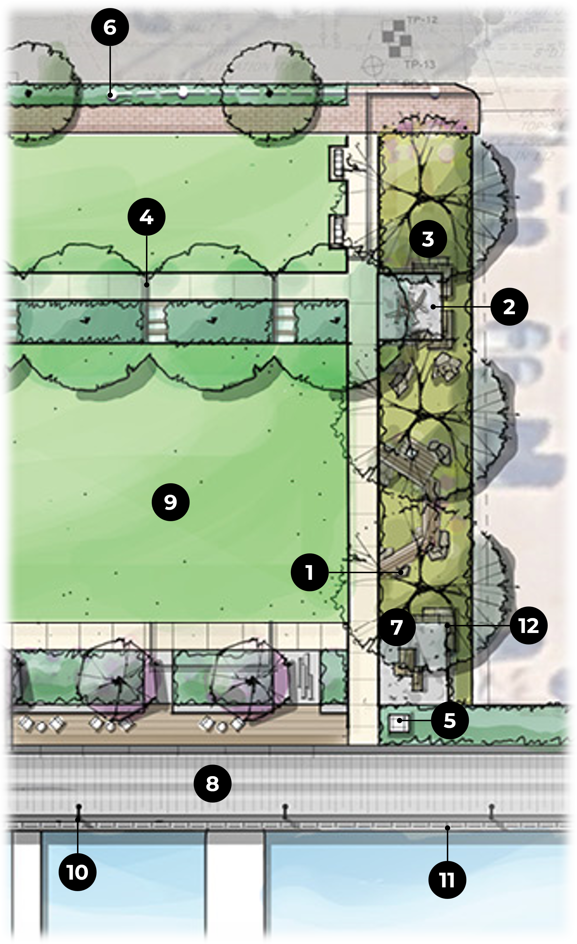
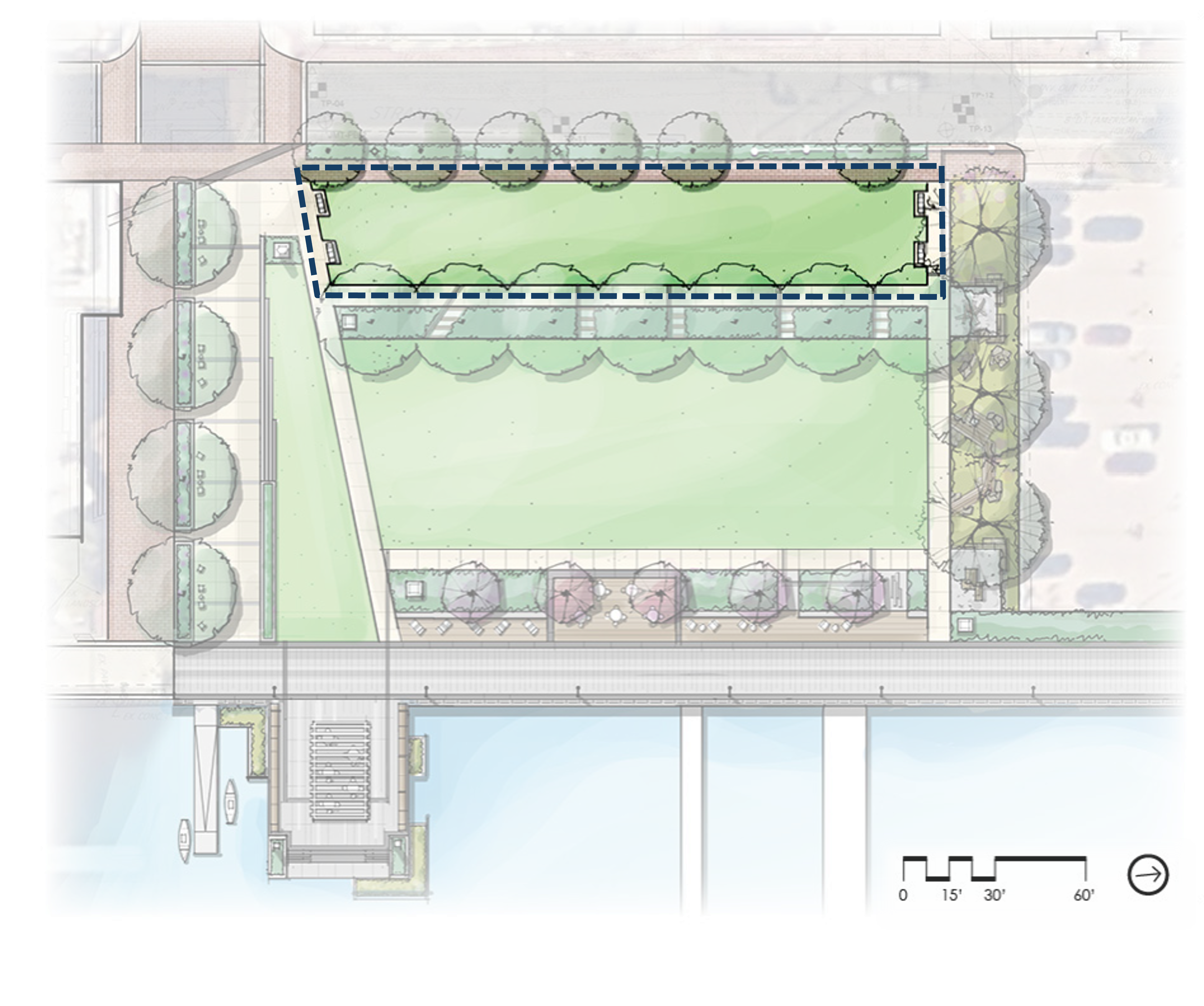
LEGEND:
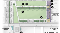
1. Shipbuilding Walk
2. Cheeseman Quay
3. Wharf
4. Great Lawn
5. Promenade
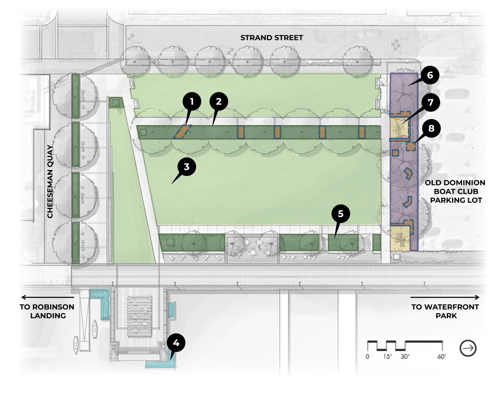
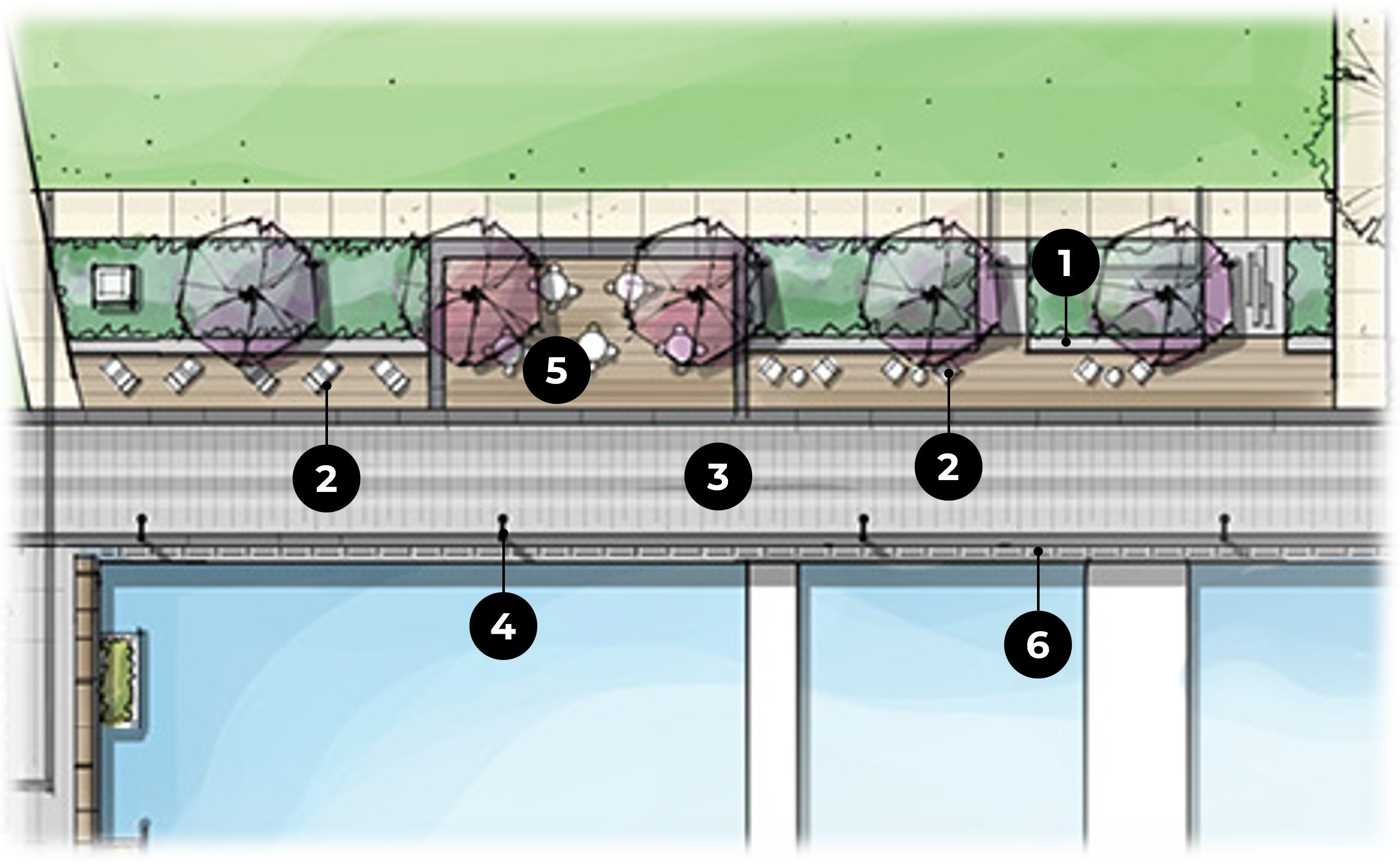
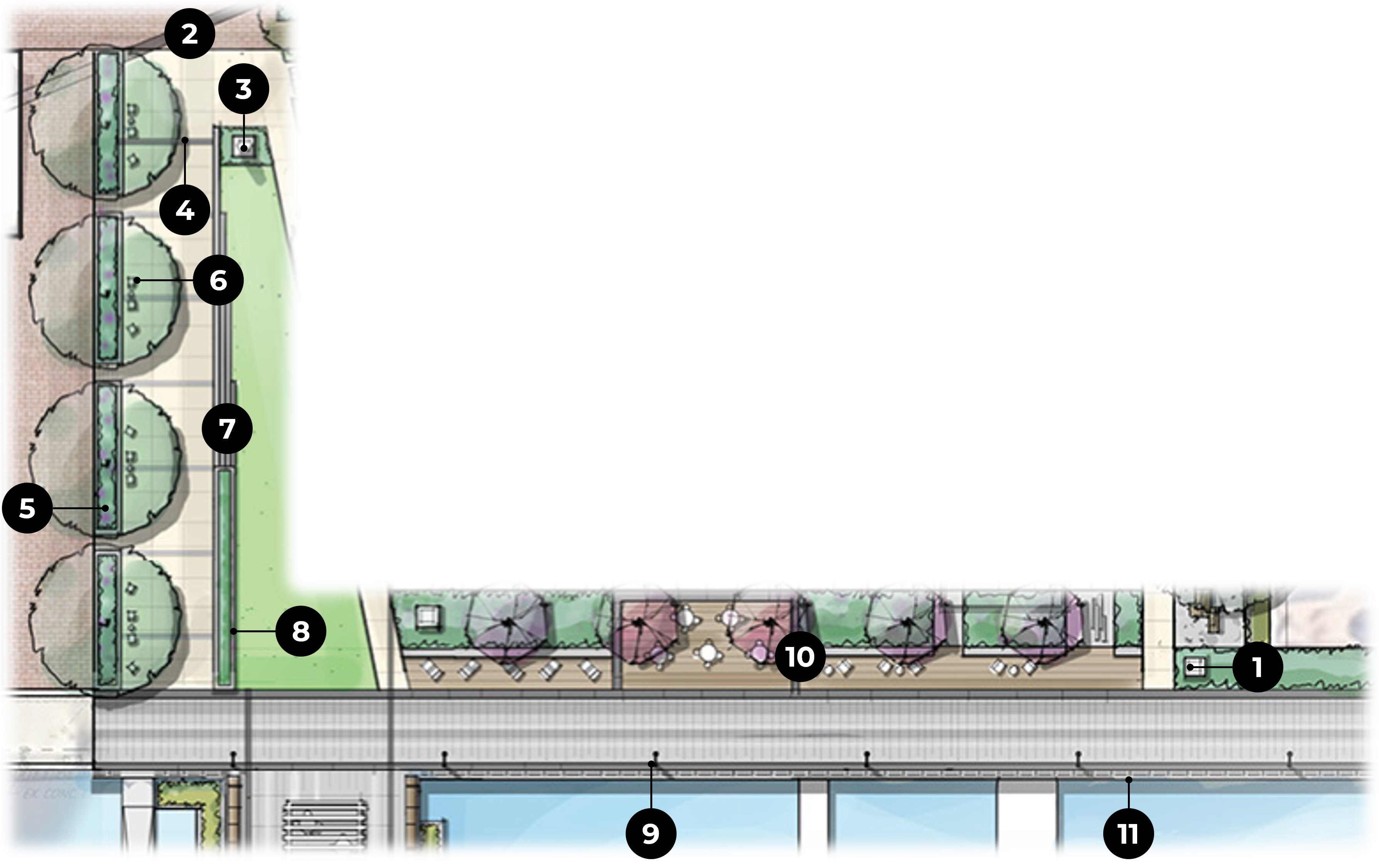
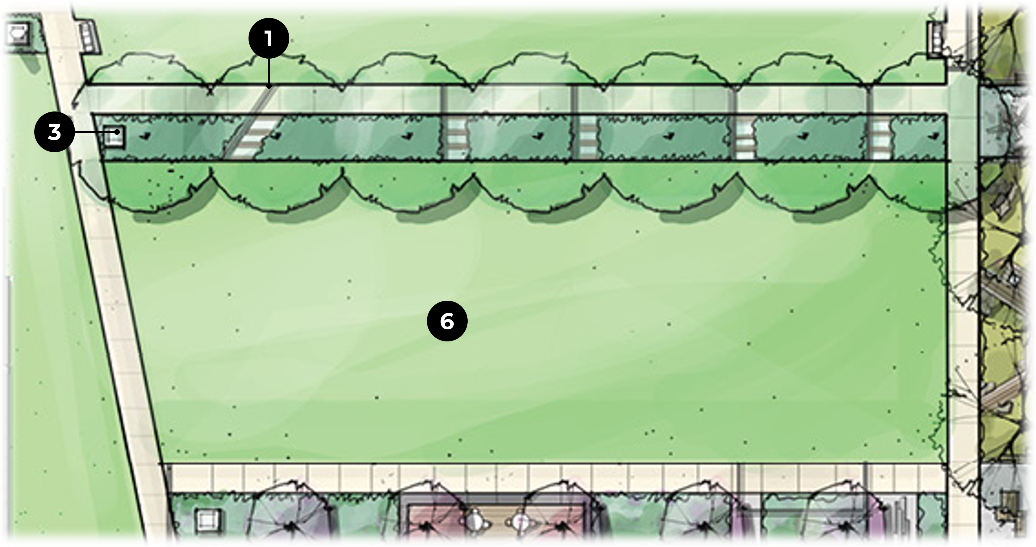
LEGEND:
1. Lawn is a pervious surface that will slow runoff rates and reduce volumes across the site. Sustainable species can be considered.
2. Trees will store carbon to reduce carbon dioxide in the air.
3. Primarily native plant beds will create habitat and attract pollinators.
4. Floating wetlands attached to bulkhead provide infiltration, runoff cleansing, and habitats.
5. The waterfront promenade will drain at less than 2% slope toward native plant beds for infiltration (rather than into river).
6. Bioretention cleanses and infiltrates runoff from impervious areas, plus provides play and education opportunities.
7. Decomposed granite (permeable hardscape) will infiltrate stormwater and slow runoff rates.
8. Historic Alexandria canal stones serve as stepping stones, walls, and landscape accents.
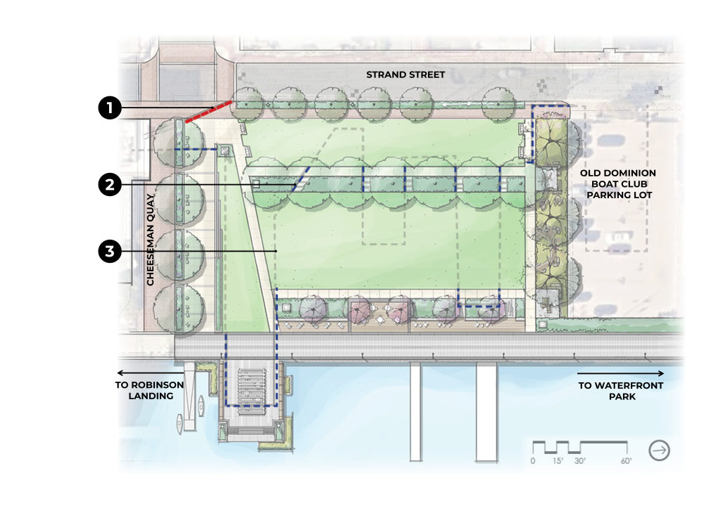
LEGEND
1. Historic 1749 shoreline band
2. Historic 1845 shoreline band
3. Approximate historic shoreline layout in gray (banding omitted in lawn due to safety concerns)
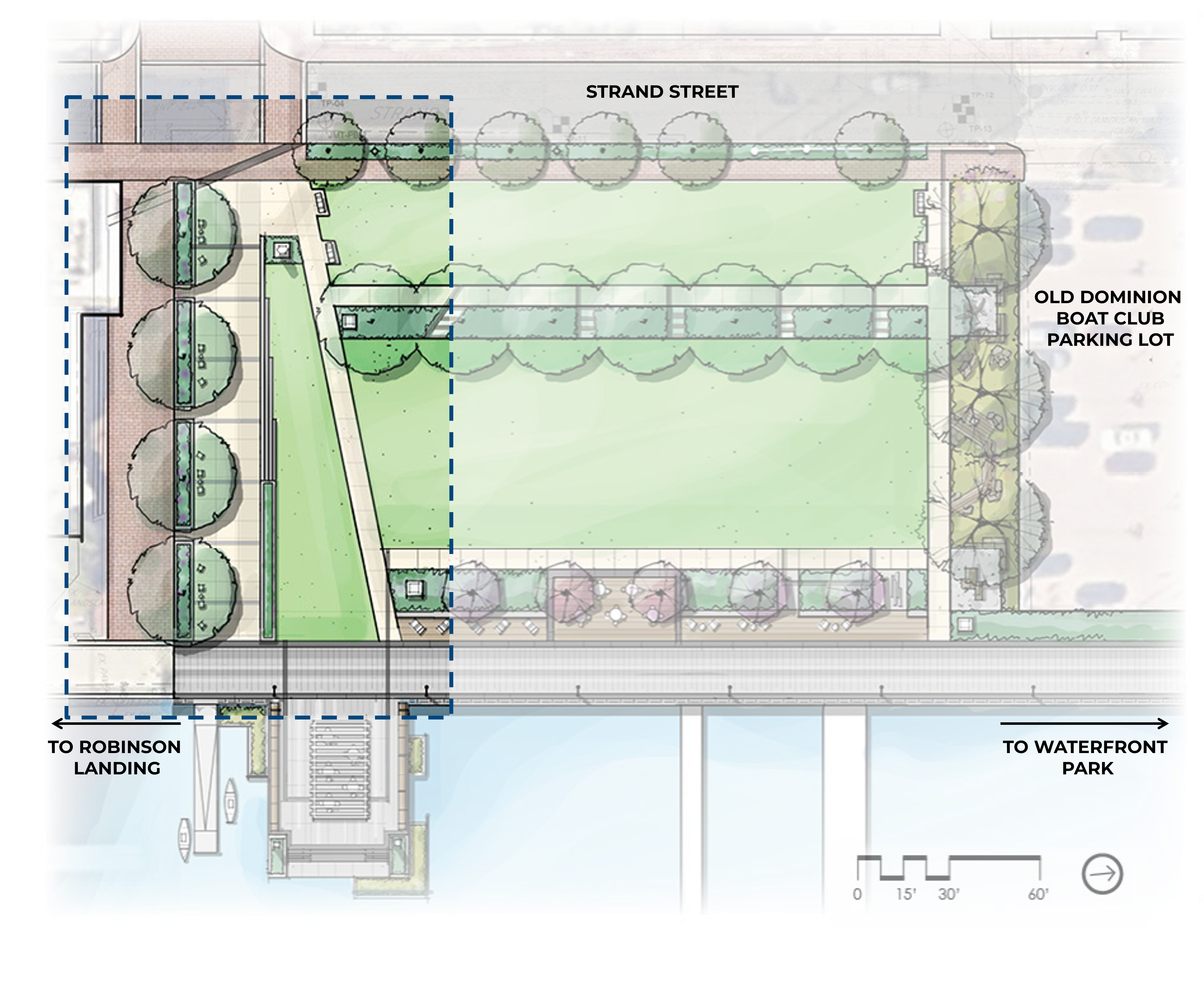
Current Plan Features
LEGEND
River Gateway/Shipbuilding Walk Design Elements
LEGEND
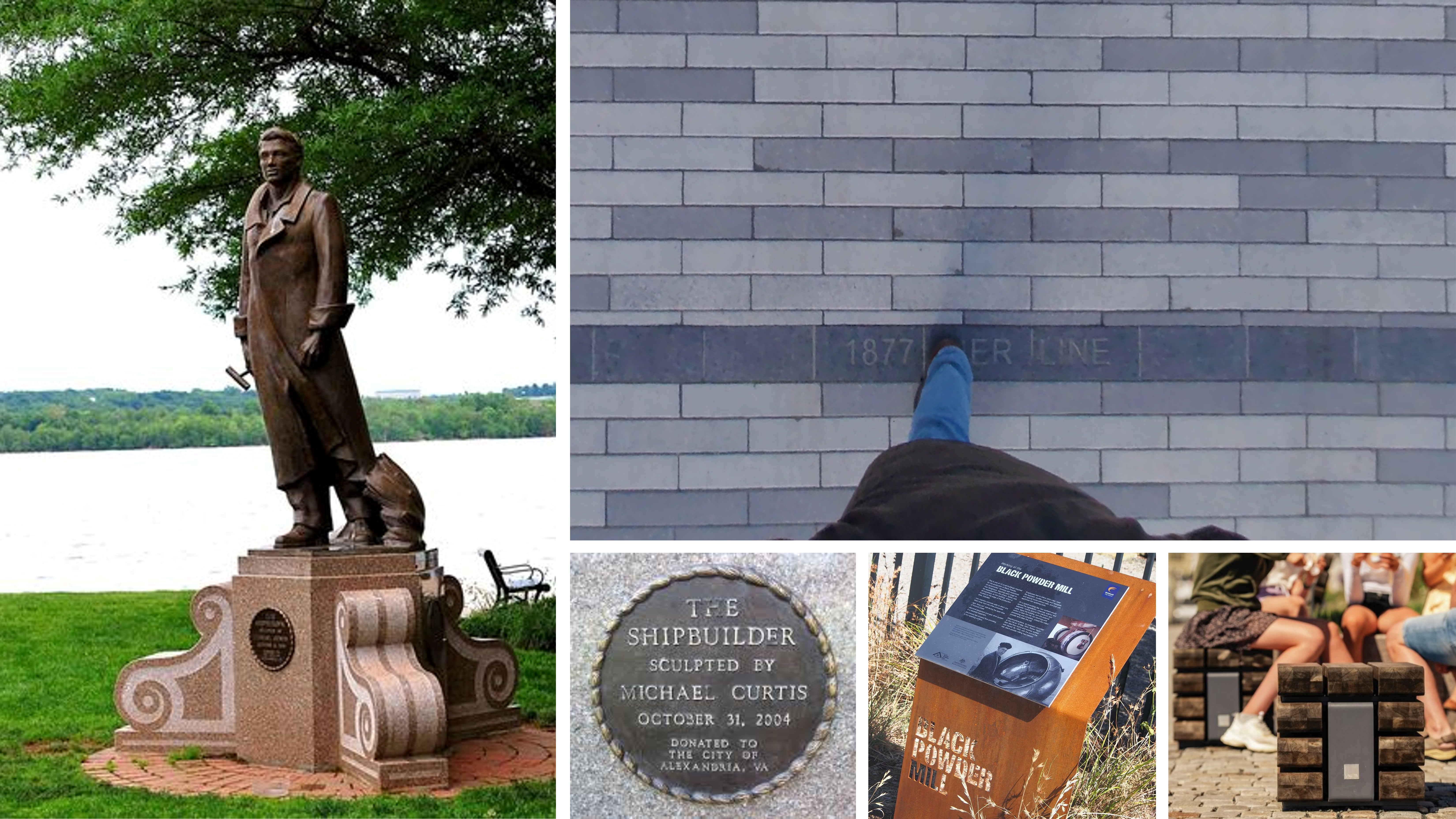
- Relocated Shipbuilder statue at arrival plaza (potential location option)
- Stone feature stairs
- Opportunity for canal-stone themed signage
- Raised planter
- Bench
- Multi-use lawn
- Signature historic 1845 shoreline inscribed paving band
- Movable seating
- Historic 1749 shoreline band
- Existing brick paving to remain
- Port history or shipbuilding themed art/signage
River Gateway/Shipbuilding Walk Design Inspiration
Wharf Elements
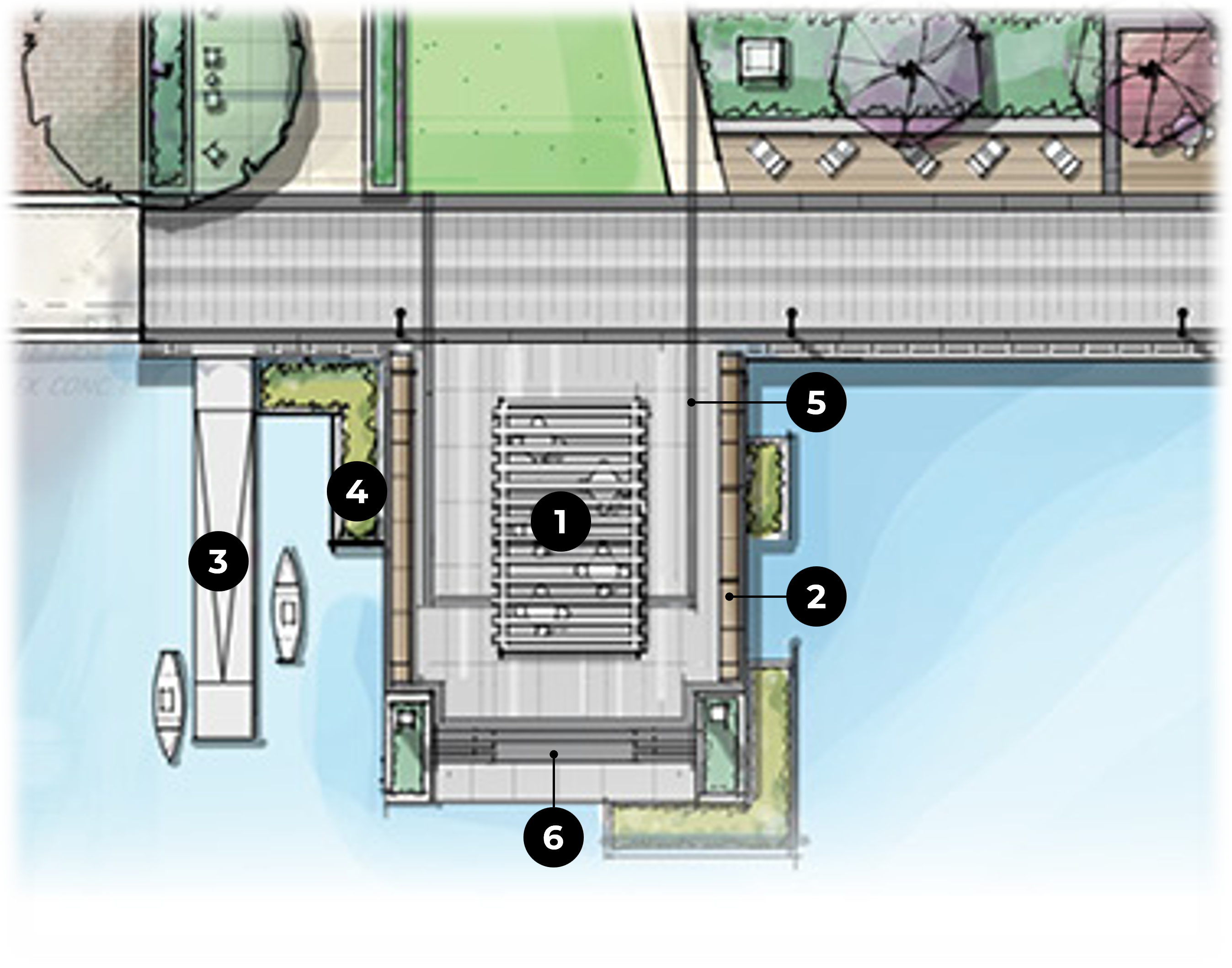
| LEGEND
|
Shade Structure
Wharf Design Inspiration

Promenade Design Elements
| LEGEND
|
Promenade Design Inspiration
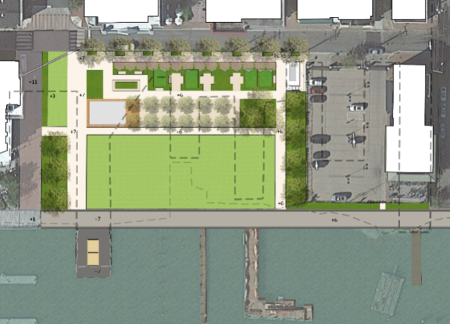
Bioretention Area Elements
LEGEND
- Canal stone seating/landscape accents
- Children’s nature play
- Bioretention
- Historic 1845 shoreline paving band/stepping stones
- African American Heritage Trail signage
- Existing utility poles to remain
- Seating/learning node
- 20’ wide promenade
- Multi-use lawn
- Light pole
- Guardrail
- Canal stacked stone wall
Bioretention Area Design Inspiration

About the African American Heritage Trail
African American Heritage Trails
- Southern Route: Stops 1 - 10
- Point Lumley Sign: Shipbuilding at Point Lumley
- Intersection of Duke Street and The Strand: Quakerism and the Anti-Slavery Movement
- African American Heritage Trail Brochure
African American Heritage Trail Elements
| LEGEND
|
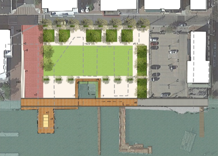
Great Lawn Design Elements
| LEGEND:
|
About the Future Rosenbaum Request Garden
H.J. and Betsey Rosenbaum have generously bequeathed $2.5M to the City of Alexandria for a garden, which will be built in the western section of Point Lumley Park. Since the garden design and construction process will take place at a future date, this aspect of the Park’s development is not included in the current review and approval process; however, the current landscape plan for Point Lumley Park was structured with the future incorporation of the garden in mind.
Site Sections
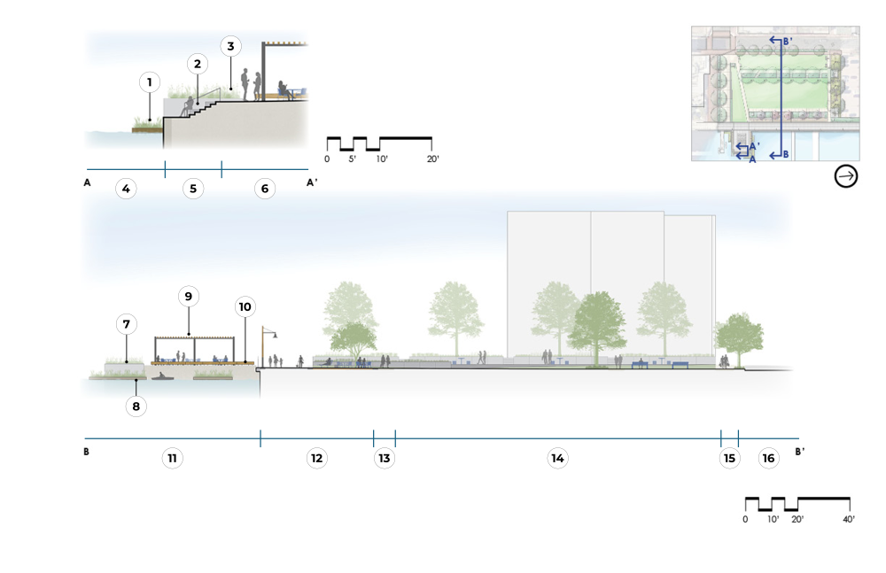
Cross-Section A: Wharf Detail
LEGEND:
1. Floating Wetland
2. Integral Seat Wall Beyond
3. Planter Beyond
4. River
5. Waterfront Stairs
6. Wharf with Seating/Signature Shade Structure
Cross-Section B: Point Lumley Park (Full Extents)
LEGEND
7. Planter
8. Floating Wetlands
9. Signature Shade Structure
10. Wood Timber Bench
11. Wharf with Shade Structure/Seating
12. Promenade and Seating
13. Walkway
14. Multi-use Lawn with Vanishing Stairs Beyond
15. Sidewalk
16. Strand Street

Cross Section: River Gateway/Shipbuilding Walk, Great Lawn, and Bioretention Area
LEGEND:
1. Movable Seating/Tables
2. Vanishing Stone Stairs
3. Sculptural Canal Stone Seating
4. Robinson Landing
5. Raised Planter
6. Shipbuilding Walk
7. Multi-use Lawn
8. Walkway
9. Multi-use Lawn
10. Walkway
11. Bioretention/Nature Play
Materials and Furnishings
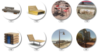
LEGEND:
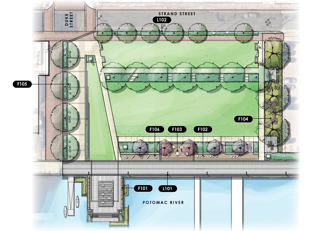
F101: Wood Timber Bench
F102: Chunky Wood Chaise Lounge
F103: Four-Top Movable Table/Chairs
F104: Stone Block/Boulder Seating (Reused Canal and/or Pioneer Mill Stones)
F105: Crate Style Seating
F106: Linear Wood Chaise Lounge
L101: Pole Light Type 1 - Promenade Nautical
L102: Pole Light Type 2 - Street Light (Alexandria Standard)
LEGEND:
F101: Wood Timber Bench
F102: Chunky Wood Chaise Lounge
F103: Four-Top Movable Table/Chairs
F104: Stone Block/Boulder Seating (Reused Canal and/or Pioneer Mill Stones)
F105: Crate Style Seating
F106: Linear Wood Chaise Lounge
L101: Pole Light Type 1 - Promenade Nautical
L102: Pole Light Type 2 - Street Light (Alexandria Standard)
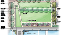
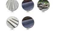
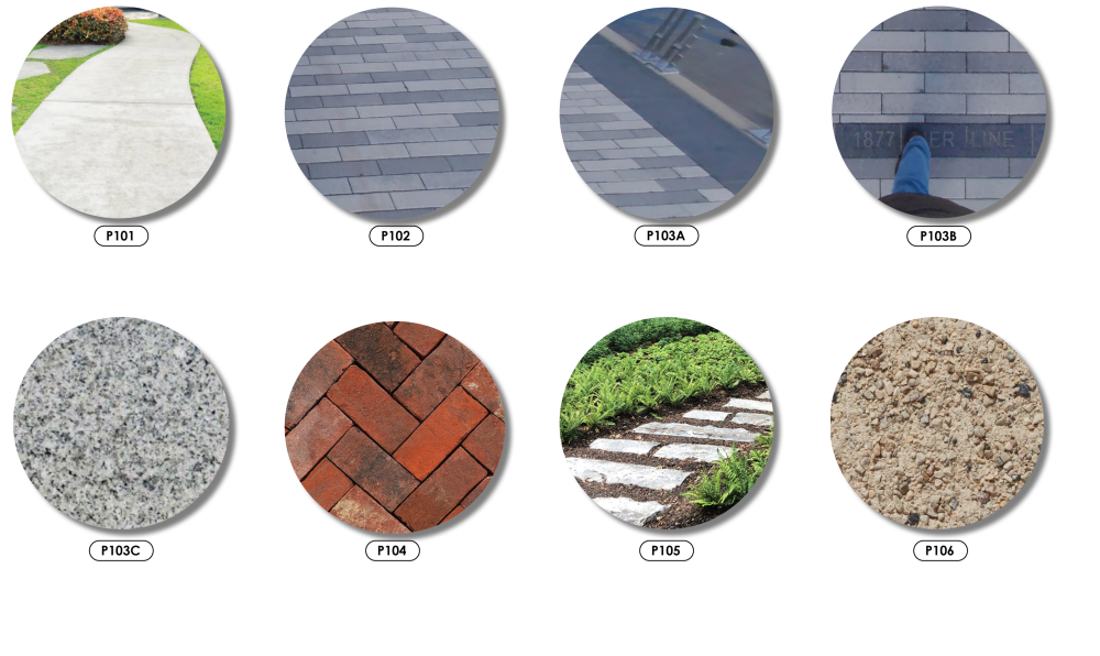
LEGEND:
P101: Poured In Place Concrete Walkway (Standard Park Walkways)
P102: Concrete Pavers (Promenade Paving)
P103A: Granite Band Type 1 - Promenade Banding
P103B: Granite Band Type 2 - Text-Inscribed Band Granite Paver
P103C: Granite Band Type 3 - Gateway Banding* Granite Paver
P104: Brick Pavers (Streetscape Sidewalk)
P105: Stepping Stones (Existing Reused Canal or Waterfront Stones)
P106: Stabilized Granite Pathway (Kafka Granite, Organic Loc, or Similar)
P107: Wood Decking (Sustainably Sourced Wood or Simulated Deck Material)
W101: Wall Type 1: Granite Seat Wall and Planter Wall (Widths and Heights Will Vary)
W102: Wall Type 2: Stacked Canal Stone Wall
S101: Stair Type 1: Poured in Place Concrete Stair
S102: Stair Type 2: Stone Feature Stair
LEGEND:
P101: Poured In Place Concrete Walkway (Standard Park Walkways)
P102: Concrete Pavers (Promenade Paving)
P103A: Granite Band Type 1: Promenade Banding
P103B: Granite Band Type 2: Text-Inscribed Band Granite Paver
P103C: Granite Band Type 3: Gateway Banding* Granite Paver
P104: Brick Pavers (Streetscape Sidewalk)
P105: Stepping Stones (Existing Reused Canal or Waterfront Stones)
P106: Stabilized Granite Pathway (Kafka Granite, Organic Loc, or Similar)
LEGEND:
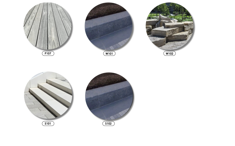
P107: Wood Decking (Sustainably Sourced Wood or Simulated Deck Material)
W101: Wall Type 1: Granite Seat Wall + Planter Wall (Widths and Heights Will Vary)
W102: Wall Type 2: Stacked Canal Stone Wall
S101: Stair Type 1: Poured in Place Concrete Stair
S102: Stair Type 2: Stone Feature Stair
Point Lumley Park Design History
The following section documents the web content previously posted about the Point Lumley Park design development.
Park and Bulkhead Improvements
| Cost-based Concept | Technically Preferred Concept |
|---|---|
 |  |
Status:
| Status:
|
* All designs are drafts, deliberative, and pre-decisional. A determination of budget feasibility is based on cost estimates. Affordability will be evaluated based on ongoing design development/engineering, cost estimation, and risk assessments.
The City determined sufficient funding was available to pursue a cost-based design* for Point Lumley Park under the budget as of Fall/Winter 2024. The design team proceeded developed the following design concepts under the cost-based design constraints:
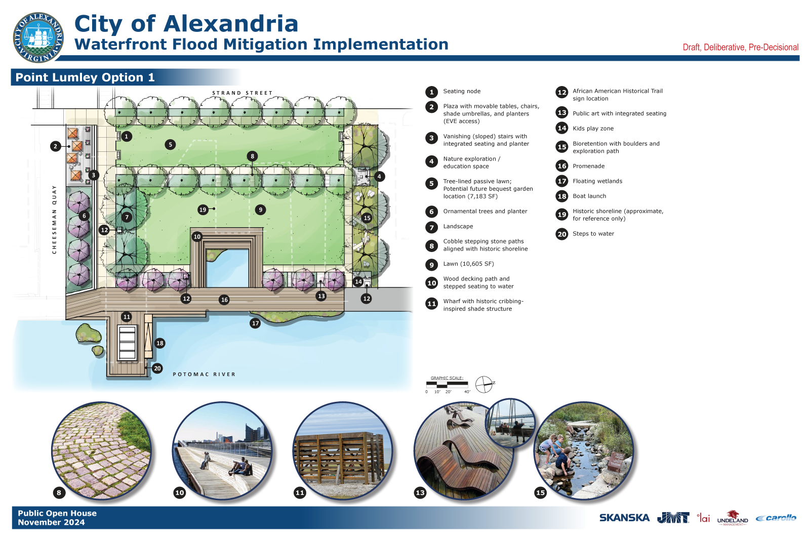
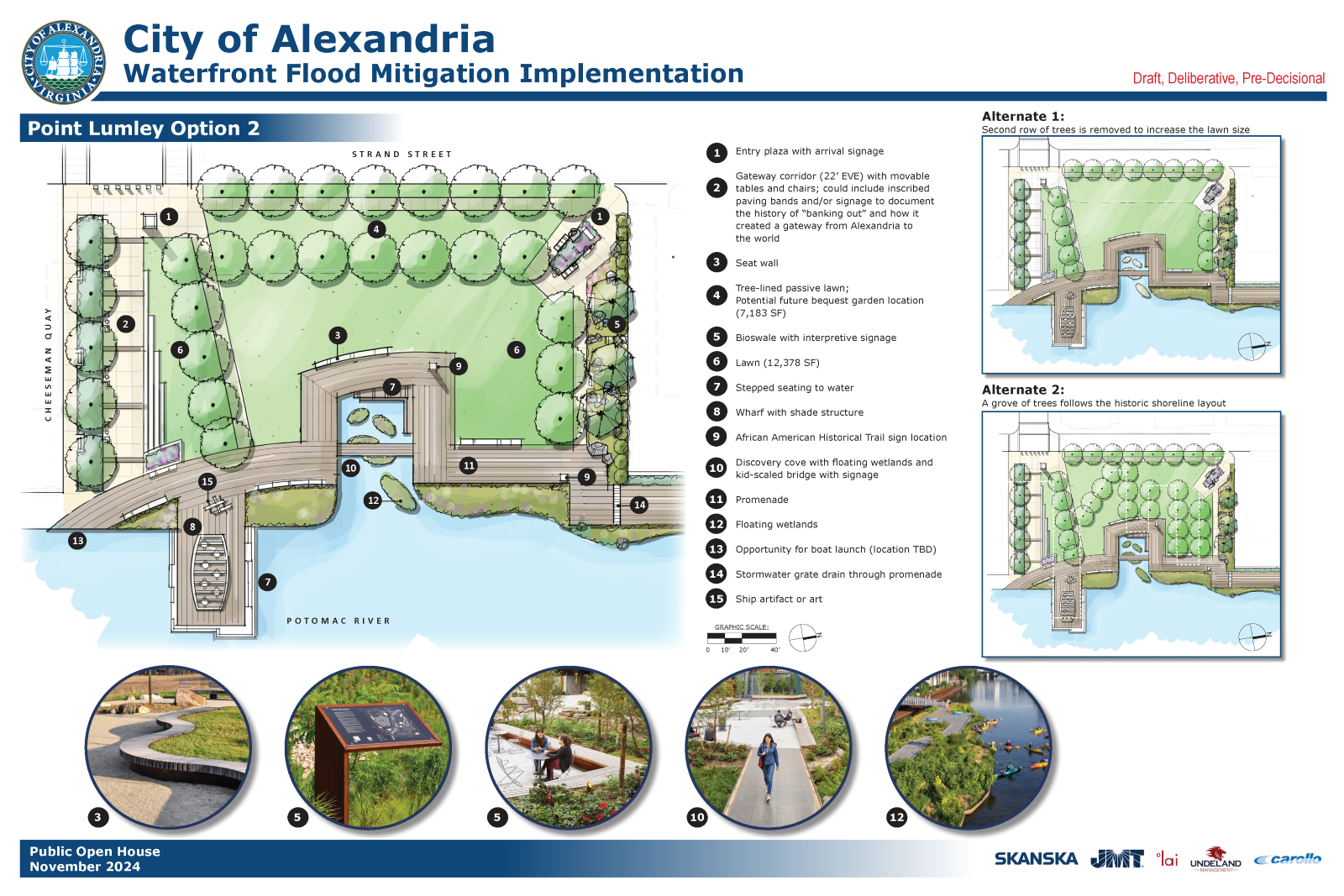
* All designs are drafts, deliberative, and pre-decisional. A determination of budget feasibility is based on cost estimates. Affordability will be evaluated based on ongoing design development/engineering, cost estimation, and risk assessments.