About the Current Design
The Waterfront Flood Mitigation Project will provide a resilient, long-term solution to mitigate flooding and replace failing infrastructure that addresses safety concerns, improves accessibility, and preserves the public’s use and enjoyment of the waterfront.
To meet these goals, the City is making strategic investments in the shoreline, flood management infrastructure, parks, and streetscape. More specifically, the Waterfront Flood Mitigation Project will provide:
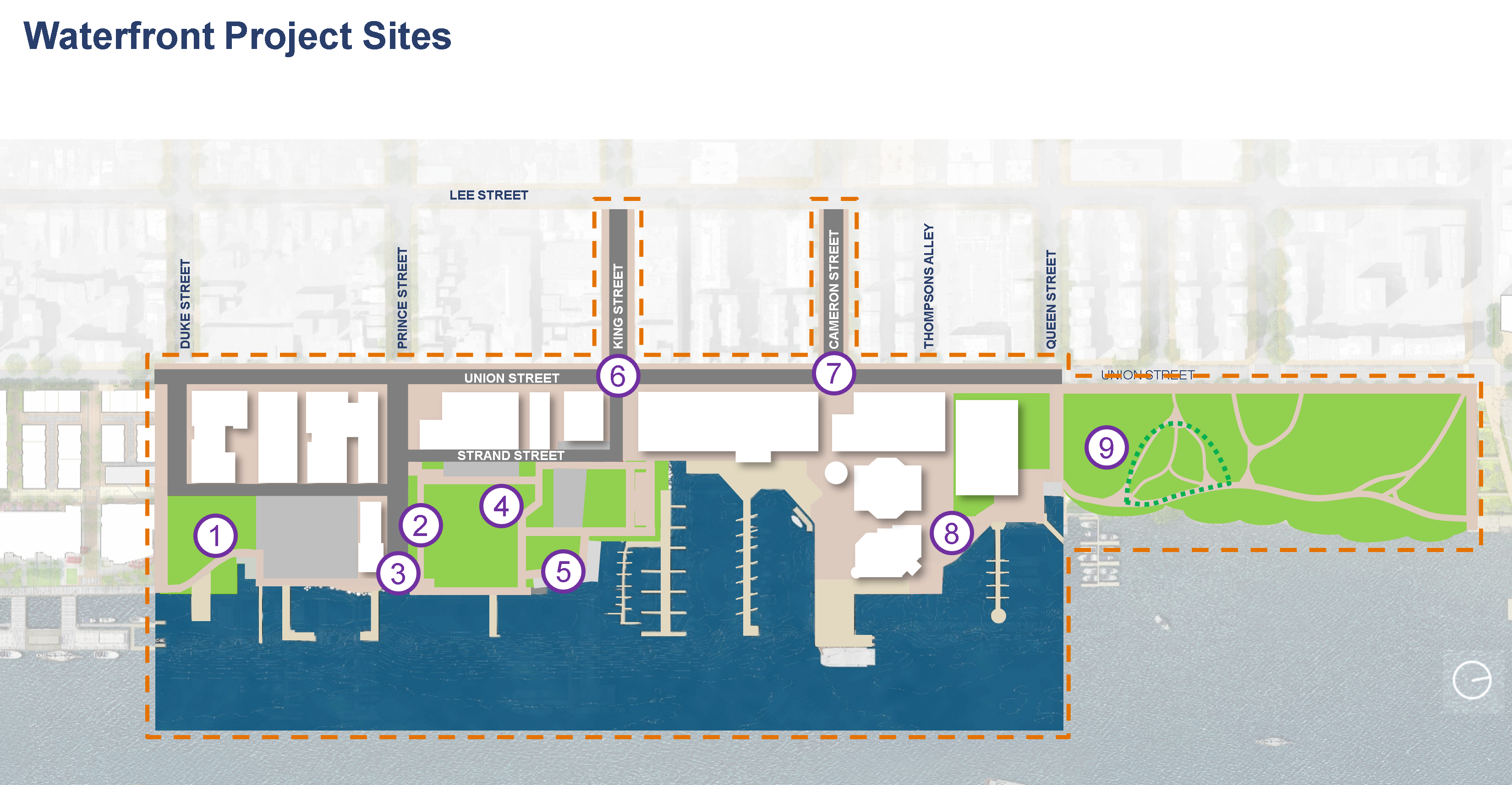
- Upgrades to Point Lumley to increase open greenspace, plantings, and site furnishings.
- A new Prince Street Pedestrian Plaza with raised planters and common seating areas.
- An enhanced Waterfront Park and King Street Park aimed to modernize programmable space, integrate and maintain existing open space, and create direct connections to the Potomac River.
- An upgrade King Street/Strand Street Pedestrian Area with new site features, like paving, sidewalks, and site furnishings, to match the Waterfront Common Elements and a curbless street design.
- A modernized storm sewer system complete with new inlets and a larger network of pipes.
- A new bulkhead and continuous promenade from Duke Street to King Street. The new shoreline infrastructure will connect from and match the recent developments completed at Robinson Terminal South to the existing Torpedo Factory promenade.
- Environmentally sound and resilient green infrastructure such as new bioretention, waterfront promenade planting, and floating wetlands.
- A fully automated pump station system to discharge collected stormwater into the Potomac River.
While the current design concept draws heavily from the Schematic Landscape and Waterfront Small Area Plan. Nearly 10 years since the City Council’s adoption of the Waterfront Small Area Plan, the design have been updated and incorporates:
- The King Street Pedestrianization Project
- Community input and preferences
- Flood mitigation and resiliency best practices
- New programming and features inspired by Alexandria’s history of shipbuilding, the African American Heritage Trail, and the Alexandria Canal, among others.
- Regulatory requirements, including cleansing of our stormwater to achieve a cleaner and healthier Potomac River.
The current design can be found below:
MAP LEGEND
Project Purpose and Need Statement
Project Purpose
The purpose of the Alexandria Waterfront Implementation Project is to provide a resilient, long-term solution to reduce nuisance flooding due to heavy rainfall events, tidal backflow, and overbank flooding of the Potomac River that negatively impacts portions of the historic waterfront district of Old Town Alexandria in a manner that addresses safety concerns, improves accessibility, and preserves the public’s use and enjoyment of the waterfront.
Project Need
Flooding results from a combination of antiquated and/or failing civil infrastructure and changing climate conditions. The storm sewer system is undersized and tidally dependent, which affects and reduces the system's intended performance. While the existing shoreline bulkhead structures are in poor and/or failing condition and require replacement. In addition, these bulkhead structures and shoreline are frequently overtopped by the Potomac River and require reconstruction to a higher elevation to provide improved levels of protection against riverine flooding. Currently, the historic district, residences, businesses, public spaces, and other infrastructure are at risk of regular flooding. These conditions are expected to worsen with more frequent and intense rainfall events, as well as rising water levels in the Potomac River. Frequent nuisance flooding restricts public and municipal access to the waterfront and portions of the historic district. This negatively impacts levels of service, tourism, economic development, and affects the overall experience of the historic district and waterfront. Implementing enhancements to the civil infrastructure will decrease the frequency and duration of flooding events, thereby reducing damage to historic properties, residences, businesses, public spaces, and infrastructure within the most affected portions of the historic waterfront district of Old Town Alexandria. This will also preserve public use and accessibility of the historic waterfront.
Design Elements: Common Threads
Three interrelated common threads will connect proposed and existing spaces to create seamless transitions and a cohesive waterfront: history, materials, and landscape.
History
- Shipbuilding
- Historic Shoreline
- African American Heritage Trail
- The Alexandria Canal
- Maritime History

Materials
- Common Elements
- Alexandria Standards
- Brick
- Granite
- Wood
- Concrete
- Metal

Landscape
- Urban Streetscapes
- Park Landscape
- Waterfront
- Promenade Planting
- Bioretention
- Floating Wetlands
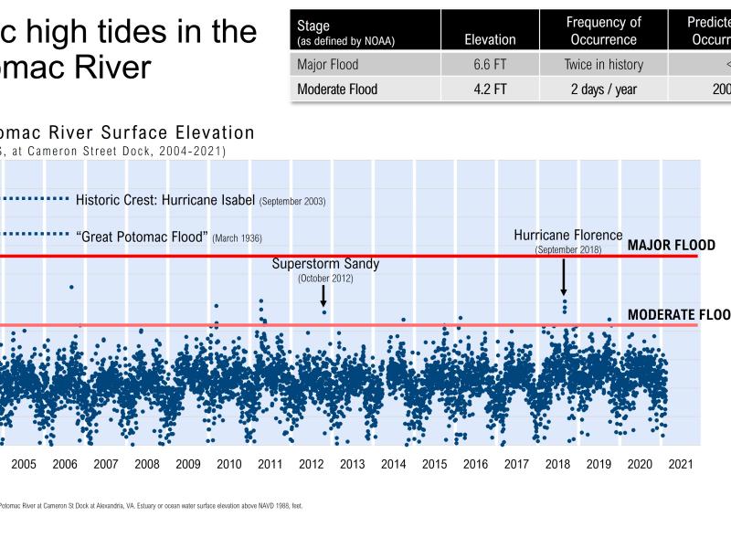
Waterfront Flooding in Alexandria
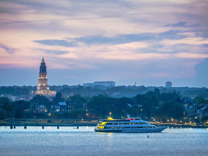
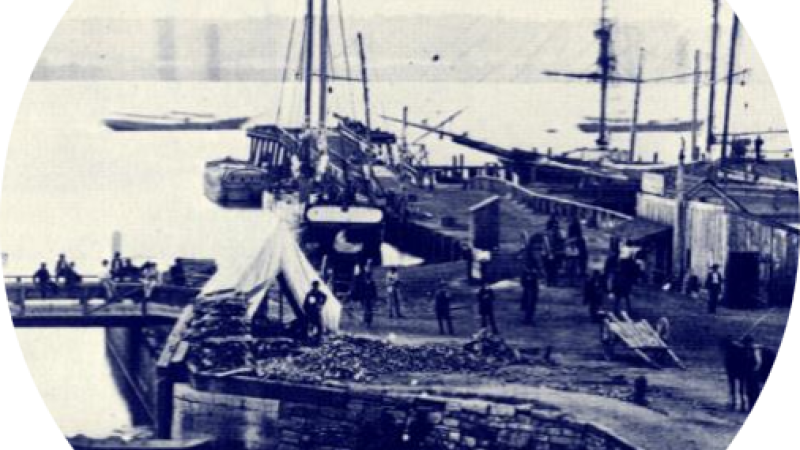
The City of Alexandria’s historic district is located along the Potomac River just south of the Washington, DC metropolitan area’s Reagan National Airport. The state of Alexandria’s current waterfront infrastructure can be traced back to the location’s use as an early seaport. As the City developed into a major port for regional and international trade in the late 18th century, inhabitants expanded the shoreline to add valuable waterfront real estate by building on sunken ship hulls and other forms of fill. Over the years, this amended shoreline was further developed and is now home to parks and trails, arts facilities, restaurants, shops, and historic homes.
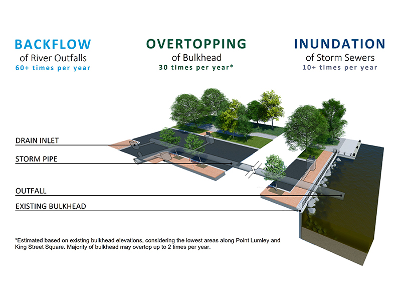
The origin of Alexandria’s contemporary shoreline and situation at sea level leaves valuable assets and public infrastructure highly prone to flooding from three different sources:
- Potomac River backflow or tidewater backing up into the sewer system
- River water overtopping the existing bulkhead
- Rainwater runoff inundating streets and sewers
Project Schedule

2019 – 2024 Timeline-To-Date
| 2019 |
|
| 2020 |
|
| 2021 |
|
| 2022 |
|
| 2023 |
|
| 2024 |
|
2024 – 2027 Anticipated Timeline
| 2024 |
|
| 2025 |
|
| 2026 |
|
| 2027 |
|
| 2028 |
|
| 2029 |
|
* Design completion date could be impacted by regulatory and grantor reviews. |
Capital Budget and Funding
The Waterfront Implementation Project budget is currently funded by the City’s Capital Infrastructure Program (CIP) funds. The City has applied for several state and federal grants, and will continue to evaluate additional alternative and external funding opportunities for the project which may help deliver more of the desired project elements:
Capital Infrastructure Program Funds (CIP Funds)
- Source: City of Alexandria
- Amount: $142 million
- Date Approved: May 2025
- Purpose: Design and construction
Virginia Community Flood Preparedness Fund Grant (DCR GRANt)
- Source: Virginia Department of Conservation and Recreation (DCR)
- Amount: $3.24 million
- Date Awarded: December 27, 2021
- Purpose: Flood mitigation and stormwater management design phase services up to 30% design. Not intended to cover costs of construction