Archaeology on the Waterfront
During redevelopment along Alexandria's waterfront, archaeologists explored the properties undergoing development. Excavations took place in 2015-2016 at the Hotel Indigo Site at 220 S. Union Street and in 2017-2018 at Robinson Terminal South, at 2 Duke Street, now a complex of residences and restaurants known as Robinson Landing.
At the Hotel Indigo Site, Archaeologists uncovered the remains of the hull of a fifty-foot vessel, as well as John Carlyle's 1755 public warehouse. Excavation took place in 2015-2016, and remains of this ship and warehouse are now undergoing conservation.
At Robinson Terminal South archaeologists located the remains of three 18th century ships, as well as foundations of Hooe's 18th century warehouse and store and the 19th century Pioneer Mill.
Archaeological excavation on these two blocks was conducted by archaeologists from Thunderbird Archaeology, a division of Wetland Studies and Solutions, Inc., working in coordination with the Alexandria city archaeologists. As required by the Alexandria Archaeological Protection Code, Thunderbird’s work is funded by the developers; Carr City Centers for the Hotel Indigo Site and EYA, LLC for Robinson Terminal South. Conservation is funded by the City of Alexandria, grants, and generous contributions to the Save our Ships Conservation Fund.
Passed by City Council in 1989, the Archaeological Protection Code requires developers to hire archaeological consultants to conduct investigations prior to construction on land with the potential to contain buried sites of historical significance. This will provide an opportunity for archaeologists to explore the 18th and 19th–century history of the City as development along the waterfront continues.
Buried Ships of Robinson Landing
Buried Ships of Robinson Landing, a temporary windowfront exhibit located at the corner of the Strand and Pioneer Mill Way, features scale models of three 18th century vessel remnants excavated by archaeologists in 2018 on the same block as the exhibit. The innovative scale models show what these ship remnants would have looked like in the late 18th and early 19th centuries. Archaeologists use these digital and physical models to compare ship construction and to answer questions about the age and use of the vessels. The exhibit opens April 6, 2024 and is designed to be viewed from the sidewalk through the end of the year.
The Four Ship Remains
Between 2015 and 2018, archaeologists excavated four ship hull remnants along the Alexandria waterfront - one from the Hotel Indigo Site (44AX229) and three from the Robinson Landing Site (44AX235).
Why were the ships in the ground? Over 200 years ago, Alexandrians repurposed the four derelict merchant ships to create new land along the Potomac River - deliberately burying the vessel remnants once they were stripped of all other useful materials. Free and enslaved laborers created this land to reach the deep water of the Potomac River, allowing larger ships to dock. Wooden structures, including the remains of the ships, held this new land in place.
What were the ships used for? The flat floors and full shape of the hulls allowed these merchant ships to carry cargo. The names of each ship remain a mystery, so their exact cargo and the ports they visited cannot be known. By the late 18th century, the Potomac River connected the bustling port city to the world. Alexandria mainly exported raw goods like tobacco and wheat, and imported manufactured goods from Europe and sugar from the Caribbean. The forced labor and the trade of enslaved individuals formed the foundation of this trans-Atlantic network.
Were the ships used to transport enslaved people? We do not know if these specific vessels carried enslaved people. Researchers studied the size and shape of the vessels and compared them to similar ships that traveled through Alexandra's port during the same time period. These documents help show the cargo the merchant ships may have carried and what places they may have traveled. In the late 18th century, Alexandria was a trading partner with the United Kingdom, Germany, France, Italy, Spain, the Caribbean, and ports along the east coast of North America. Newspaper records do not identify ships trading directly between Alexandria and the African continent, but Alexandrians were involved in, and heavily profited from, the trade of enslaved people.
Are they still in the ground? No, only a portion of Robinson Landing Ship 3 remains under the foot of Wolfe Street because it was outside of the project (construction) area. Both areas are now underground parking garages.
| Ship | Claim to fame | Ship type | Measurements | Tons |
| Hotel Indigo Ship | First 18th century vessel excavated in Alexandria | Brig or sloop | Length: 70 feet Width: 18.5 feet Depth: 4.75 feet | 104 tons |
| Robinson Landing Ship 1 | Small vessel built to sail along rivers and the coast, and to carry goods short distances from moored ships | Lighter | Length: 49 feet Width: 13.8 feet Depth: 6.5 feet | 37 tons |
| Robinson Landing Ship 2 | Mid-size ship built to carry cargo | Sloop | Length: 62 feet Width: 46 feet Depth: 7 feet | 90 tons |
| Robinson Landing Ship 3 | Largest known colonial merchant vessel to be excavated | Ship | Length: 102 feet Width: 25.25 feet Depth: 11 feet | 264 tons |
Ship Conservation and Stabilization
Researchers from the Conservation Research Laboratory at Texas A&M worked with Alexandria Archaeology staff and an amazing team of volunteers to document the three ships that were found at the Robinson Terminal Site in 2017-2018. All three ships have been laser scanned and reconstructed using computer models and 3D printing.
The Historic Ship Stabilization: Ship Ponding project included the stabilization and storage of these three historic ship remnants excavated at the Robinson Landing Site. The overall goal of the project was to transport and store the timbers in Ben Brenman Pond (4800 Brenman Park Dr.) in a manner that preserves the possibility of future study and conservation when adequate funding and/or a location for permanent storage or display is available. Planning for the longer-term storage of the historic ship timbers began shortly after the ships were discovered in 2018.
The Conservation Research Laboratory also continues conservation of the first ship, discovered at the Hotel Indigo Site in 2015. This is a multi-year projects because of the size and complexity of the remains.
The wooden timbers from John Carlyle's 1755 public warehouse were conserved at the Maryland Archaeological Conservation Laboratory.
Learn more about Managing Alexandria’s Derelict Merchant Fleet: Documenting, Preserving, and Interpreting Four Historic Ships from the Hotel Indigo (44AX229) and Robinson Landing (44AX235) Archaeological Sites. (Alexandria Archaeology Publications, No. 132)
Waterfront Sites
- Robinson Terminal South, 2 Duke Street (2017-2018)
- Hotel Indigo Site, 220 N. Union Street (2015-2016)
- Lee Street Site, 200 block N. Lee Street (1997)
- Alexandria Canal, Trans-Potomac Canal Plaza, 600 block N. Fairfax Street (1989)
- Roberdeau’s Wharf, Harborside, 400 block S. Union Street (1989)
- Carlyle-Dalton Wharf, Residences at the Torpedo Factory, 100 block N. Lee Street (1982)
- Keith’s Wharf, Ford's Landing, 700 block S. Union Street (1988)
Excavation Highlights
Alexandria's 18th Century Ship Sets Sail (2017) - Extending the Shoreline: The Bulkhead Wharf
- John Carlyle’s Public Warehouse (Hotel Indigo Site field update, November 2015)
- Robert Townsend Hooe Warehouse and Store (Robinson Terminal South field update, April 2017)
- Pioneer Mills (Robinson Terminal South field update, November 2017)
Robinson Terminal North
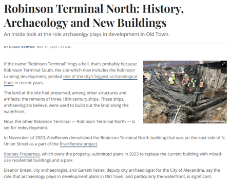
If the name “Robinson Terminal” rings a bell, that’s probably because Robinson Terminal South, the site which now includes the Robinson Landing development, yielded one of the city’s biggest archaeological finds in recent years.
The land at the site had preserved, among other structures and artifacts, the remains of three 18th-century ships. These ships, archaeologists believe, were used to build out the land along the waterfront.
Now, the other Robinson Terminal — Robinson Terminal North — is set for redevelopment.
In November of 2020, AlexRenew demolished the Robinson Terminal North building that was on the east side of N. Union Street as a part of the RiverRenew project.
Rooney Properties, which owns the property, submitted plans in 2023 to replace the current building with mixed-use residential buildings and a park.
Eleanor Breen, city archaeologist, and Garrett Fesler, deputy city archaeologist for the City of Alexandria, say the role that archaeology plays in development plans in Old Town, and particularly the waterfront, is significant. (Read the full article, below.)
Robinson Terminal North: History, Archaeology and New Buildings: An inside look at the role archaeology plays in development in Old Town. by Grace Kenyon, Alexandria Living, May 17, 2024.
Waterfront History
Alexandria Waterfront Documentary Study
A comprehensive study is underway on a six-block area along the waterfront, in advance of flood mitigation. The final product will be a comprehensive report on the historical development of this six-block area. This report will serve as the historical guide for archaeological assessments of proposed and future infrastructure and development projects within this portion of the waterfront. Learn More.
Additional Resources
- Resources for the Study of the Alexandria Waterfront. Resources for the study of events, people, and buildings important to the history and archaeology of the waterfront.
- Historic Buildings and Places on the Waterfront. History and images of historic buildings along the waterfront, and maps showing the location of these historic resources.
- Travelers' Accounts of the Historic Alexandria Waterfront. Descriptions of Alexandria by travelers from the early 17th century to the early 20th century.
- Pondering Shorelines, part 1; and Pondering Shorelines, part 2. Adapted from “‘On Examining the Records of the Town we find an Omission’ Using Historical GIS (hGIS) in Conjunction with Archaeological Excavation to Document Property Histories and Understand Changing Waterlines in Alexandria, Virginia.” Paper presented at the Society for Historical Archaeology Conference, January 2020 by Benjamin Skolnik.
African American Heritage Trail
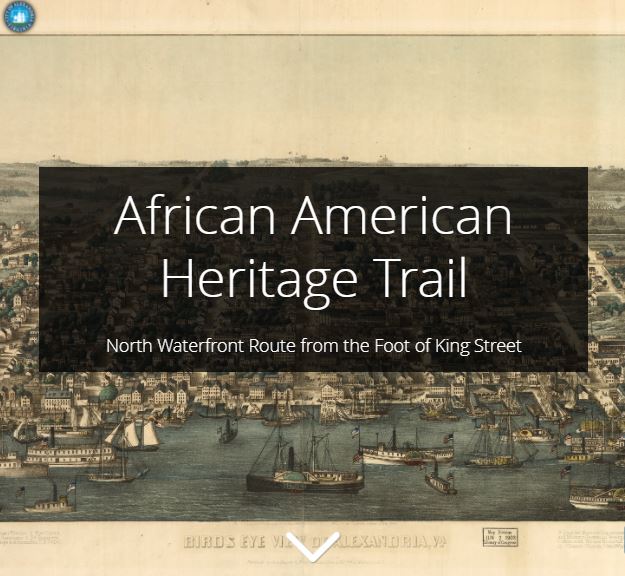
Alexandria’s African American history is told through online StoryMaps and can be experienced in-home on your computer or on your smartphone as you walk the trail along the Potomac River. Also see footnoted version of the tour texts, with linked references.
The Trails currently have two routes along the Waterfront. The African American Heritage Trail will grow in the coming years to consist of several interconnecting routes across the City of Alexandria.
Alexandria Heritage Trail Signs on the Waterfront
These signs are listed from north to south along the waterfront.
- Plundered War of 1812 (Torpedo Factory arcade, 101 N. Union Street, near the Timeline)
- Foot of King Street (King Street, east of Union Street)
- The Domestic Slave Trade (Waterfront Park, east of The Strand and south of King Street)
- Raise the White Flag War of 1812 (Waterfront Park, 1a Prince Street)
- Industrialization on the Strand (211 Strand, Watermark Condominiums)
- Waterfront Archaeology (211 Strand, Watermark Condominiums)
- Keith's Wharf (between Powhatan Park and Jones Point Park)
- Ford's Landing: Look for a series of historic signs on the waterfront walkway at Ford's Landing, at the east end of Franklin Street. (PDF unavailable)
- Jones Point: Visit 17 historic markers placed at Jones Point Park by the National Park Service. The Park is at 1 Jones Point Drive (walking access from the north end of Royal Street. (PDF unavailable)
Alexandria Waterfront History Plan
Prior to the current waterfront redevelopment, the Alexandria Archaeological Commission prepared the Alexandria Waterfront History Plan in 2010. A subcommittee of the Commission, the Archaeological Commission Ship Committee, is now tasked with coming up with recommendations about what will happen with the ship(s) that were found during archaeological excavations along the waterfront. Meetings are announced on the City calendar.