What are smart signals?
Adaptive traffic signals adjust in real time to what’s happening on the road. Using cameras to understand how many vehicles are waiting at each intersection, the system can make small timing changes to keep traffic moving more smoothly along the corridor.
Today, most traffic signals in Alexandria operate on set schedules based on the time of day. This project upgrades that approach by allowing signals to respond to changing conditions—like heavier traffic, incidents, or special events—as they happen. The result is a more reliable and efficient travel experience for everyone, including people driving, riding the bus, and emergency responders.
What's New
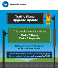
Work is currently underway on Duke Street and South Van Dorn Street. Temporary delays may occur while crews are onsite. Check our socials for the latest on active work locations.
Project Background
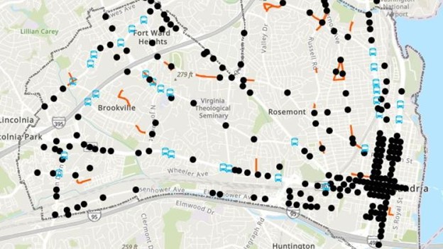
This project focuses on upgrading how traffic signals operate along key corridors so they can better reflect how people are actually moving throughout the day. By adding new detection and management technology, the City will be able to better understand traffic patterns, identify where congestion is forming, and make adjustments that help intersections work more efficiently.
The project will be implemented in two phases, allowing the City to build and expand the system over time while ensuring it is working effectively. As the system comes online, signals will be better coordinated across the corridor, helping traffic flow more smoothly from one intersection to the next.
Overall, this investment helps the City take a more proactive, data-driven approach to managing the transportation network—supporting safer intersections and more reliable travel for everyone.
Project Timeline
- Planning: 2024 – 2025
- Design: 2025 – 2027
- Construction: 2028 – 2029
- Completion: Anticipated 2029
Project budget
- Total Budget: $7.6M
- Funding Source(s): SmartScale