You're logged in with MyAlex  |  Logout

City of Alexandria, VA

Search results cleared

Include archived pages
Most of the content here is written in English. Translate your search to find more content? Translating "" to English... Searching for English phrase ""
  • Live
  • Play
  • Services
  • Business
  • Government
  • Projects & Plans
  • Calendar
  • I want to…

Sanger Avenue Safety Improvements

A City of Alexandria project to improve traffic safety.
Page updated on November 12, 2024 at 8:58 AM

Transportation Planning

  • Alexandria Mobility Plan
  • Alexandria Transit Vision Plan
  • Bicycle Parking
  • Bus Rapid Transit Network
  • Complete Streets
  • Dockless Mobility
  • Traffic & Parking Board
  • T&ES

Share

Bluesky Share on Facebook Share on X Share via Email
Translate icon
Translate icon
XWARNING: You have chosen to translate this page using an automated translation system. This translation has not been reviewed by the City of Alexandria and may contain errors.

Project Description

The purpose of this project is to evaluate improvements to make it easier and safer for people of all ages, abilities, and modes of travel to use Sanger Avenue.
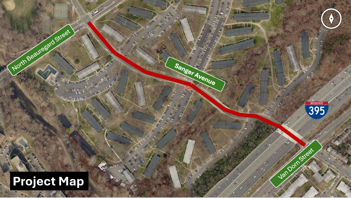
Project Area Map

Map of project boundaries for Sanger Avenue Safety Improvements

Project Background

Sanger Avenue, between North Beauregard Street and Van Dorn Street, is a four-lane east-west roadway that provides access to various high-density residential neighborhoods, schools, and bus lines. 

There have been over 60 traffic crashes since 2016 on this stretch of Sanger Avenue alone. Of those, over a third resulted in people being injured. Speeding is also common on this corridor, presenting a high risk of injury to people walking, biking, and taking transit. 

Safety improvements are being considered for this stretch of Sanger Avenue to improve safety for children and adults walking to the William Ramsay Recreation Center and Ferdinand T. Day Elementary School, protect bus riders boarding/alighting the new West End Transitway, and make it safer for vehicles traveling between North Beauregard Street and Van Dorn Street by decreasing the likelihood of dangerous weaving patterns and angled crashes. 

A Safe Routes to School (SRTS) project was recently approved for William Ramsay Elementary, with curb extensions, crossing improvements, and a raised crosswalk coming soon. Multimodal safety improvements to Sanger Avenue are also recommended in the Safe Routes to School Walk Audit for Ferdinand T. Day Elementary.

Sanger Ave will be a key artery of the West End Transitway. Traffic safety improvements are needed to protect riders and bus operators, and also to ensure safe transit operations.

Project Development

Community Engagement

Status: Initiated

Stay tuned for opportunities to provide feedback! 

Planning & Concept Design

Status: Initiated

Stay tuned for updates!

Alexandria Mobility Plan

LEARN MORE ABOUT THE CITY'S ADOPTED TRANSPORTATION PLAN.
https://www.alexandriava.gov/MobilityPlan

Vision Zero

LEARN MORE ABOUT WHAT THE CITY IS DOING TO IMPROVE TRAFFIC SAFETY.
https://www.alexandriava.gov/VisionZero

Complete Streets

LEARN MORE ABOUT WHAT THE CITY IS DOING TO MAKE IT EASIER TO WALK, BIKE, AND RIDE TRANSIT.
https://www.alexandriava.gov/CompleteStreets

Transit Program

LEARN MORE ABOUT THE CITY'S TRANSIT PLANNING EFFORTS.
https://www.alexandriava.gov/Transit
Contact Us
Alex311 | 703.746.4311
Follow Us
  • BlueSky
  • Facebook
  • X
  • YouTube
Visitor Information

VisitAlexandriaVA.com

  • Jobs
  • Payments
  • Departments
  • Newsroom
  • Social Media
  • Emergency Hotlines
  • Accessibility
  • FOIA Requests
  • Privacy & Legal

Alexandria City Hall
301 King Street
Alexandria, VA 22314

City of Alexandria Seal
© 1995–2023 City of Alexandria, VA and others.
Hold on, redirecting...