About the Bus Stop Program
The City of Alexandria has just under 700 bus stops, with service from DASH, Metrobus, and other regional providers. The City is responsible for implementing various improvements to bus stops, such as meeting Americans with Disabilities Act (ADA) requirements, and adding and maintaining bus shelters, seating, bike racks, real-time information displays and other amenities to make transit more accessible, comfortable, and convenient for residents and visitors.
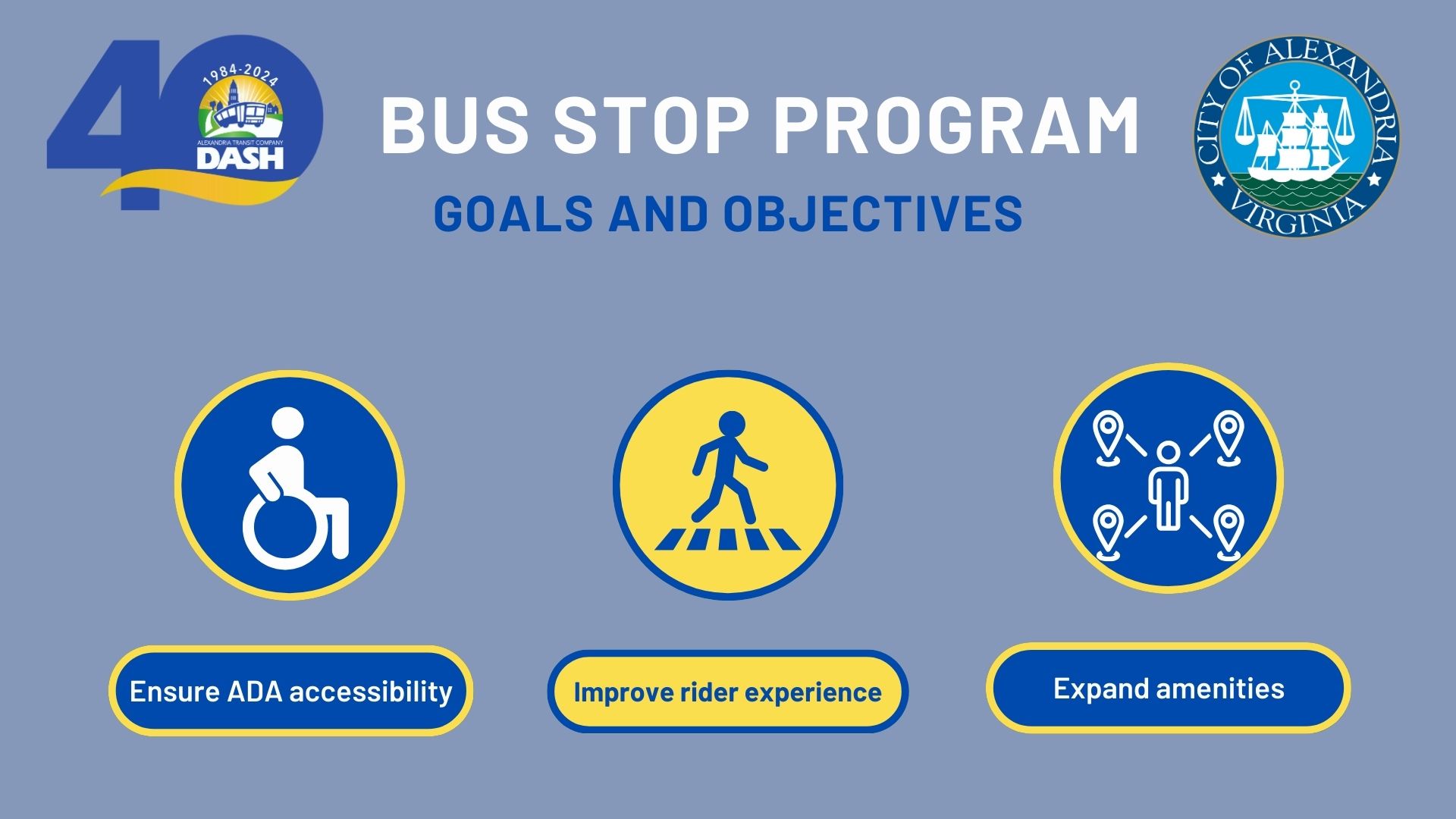
Program Goals and Objectives
The Bus Stop Program seeks to ensure ADA accessibility, improve the rider experience, and expand amenities. The Alexandra Mobility Plan (AMP) outlines ways to make transit simpler, less expensive, and more convenient. The goals and objectives of the Bus Stop Program are derived from the Transit Chapter of the AMP, specifically Strategy 4 which includes
- Ensuring all bus stops are fully accessible per the Americans with Disabilities Act (ADA) and considering opportunities to improve access to bus stops through improving sidewalk, bicycle, and ramp connections.
- Improving the rider experience from trip planning, to accessing the stop, riding the bus, and arriving at the destination.
- Implementing bus stop amenities including shelters, real-time signage, seating, lighting, and natural amenities to improve comfort and safety.
These goals and objectives help to advance other City transportation, safety, and stewardship plans and goals, such as:
Interactive Bus Stop Program Dashboard
Major Projects
Old Town Circulator Stop Rebalancing
The Old Town Circulator (OTC) corridor is one of the highest-ridership routes in the City of Alexandria, and continued ridership growth underscores the need for strategic improvements. The current stop configuration is inefficient, with average stop spacing of 598 feet, which is well below the 1,320-foot average for urban areas (NACTO). This inefficient stop spacing contributes to slower travel times and reduced reliability.
Rebalancing stops will create more effective stop pairs that improve bus performance, enhance passenger mobility, and support ADA accessibility upgrades. The proposed approach also aligns with and leverages new development along the corridor. While some parking removal may be necessary to support ADA accessibility improvements at bus stops, parking will be restored at other locations along the corridor. Pursuing stop rebalancing in advance of the City of Alexandria’s Madison Street Corridor Complete Streets project is critical to informing safety enhancements and ensuring coordinated, cost-effective investments that benefit both riders and the broader community.
Project Timeline:
Planned parking modifications were approved at a Traffic and Parking Board Public Hearing on February 23, 2026. Minor construction on bus boarding pads is expected to occur in Spring 2026. Implementation of bus stop rebalancing is expected to occur in August 2026.
ADA Upgrades
The City is working to regularly upgrade bus stops citywide in accordance with Americans with Disabilities Act (ADA) requirements. This work includes parking removal, concrete pad upgrades, improved curb ramps, and other accessibility and safety improvements that benefit all bus riders, especially persons with disabilities.
Since Fall 2024, 60+ ADA pad upgrades have been installed in Alexandria. In Spring 2026, the City improved over 20 bus stops with concrete pad upgrades!
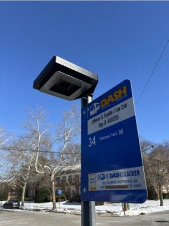
Solar Lighting Improvements
The City is working to regularly upgrade illumination at transit stops to improve visibility, safety, and the bus rider experience. The lighting units are solar powered, and can be programmed to activate whenever it is dark outside and increase in brightness when a rider is near a bus stop.
20 solar lights were be installed at priority bus stops across Alexandria in February 2026!
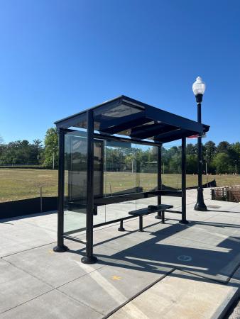
Bus Shelter Enhancements
The City is working regularly to upgrade bus shelters at transit stops to improve comfort and safety for transit riders.
In Spring 2026, the City installed 4 new bus shelters at priority bus stop locations!
Bus Shelters - Phase II
The City is working to install new bus shelters at priority locations throughout the City.
- Phase I of this work was completed in 2019 and consisted of 28 new bus shelters.
- Phase II of the Bus Shelters project is currently underway.
- Site selection was completed in 2023
- Design was completed in 2025
- Installation of the next 20 shelters will be completed by 2027
Duke Street Transitway
The City of Alexandria is working to implement transit improvements along the Duke Street corridor to support Bus Rapid Transit (BRT), enhanced multimodal facilities and improved bus stop amenities as called for in the Alexandria Mobility Plan.
West End Transitway
The City of Alexandria is working on implementing infrastructure upgrades at key intersections along the corridor, installing BRT shelters, and creating an operations plan. Service on the West End Transitway is expected to begin in FY 2027.
US 1 Metroway
Metroway is an active BRT route between Alexandria’s Braddock Road Metro and Pentagon City Metro in Arlington County. Alexandria is working to extend dedicated Metroway facilities to the Arlington County line.
Bus Stop Inventory
The City works closely with partners like DASH to maintain a comprehensive bus stop inventory with detailed information about stop locations, ADA compliance, routes served, accessibility, and various amenities like shelters, seating, bike racks, lighting, and real-time information displays. The inventory was completely updated in Summer 2025.
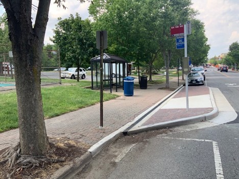
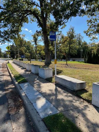
Accessible bus stop (bus bulb with curb cut in front of stop) in Alexandria
Amenities
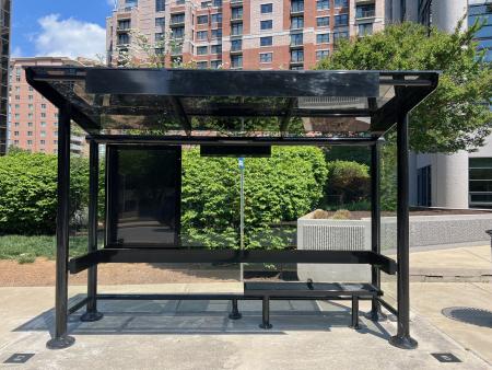
Bus Shelters
Bus shelters are provided at roughly 160 of the highest ridership stops throughout the City of Alexandria. The City is in the process of installing new bus shelters and replacing older ones at locations throughout the city. The City’s Standard Bus Shelter Model is the Brasco Eclipse, an off-the-shelf model that is less expensive and easier to maintain than custom models.
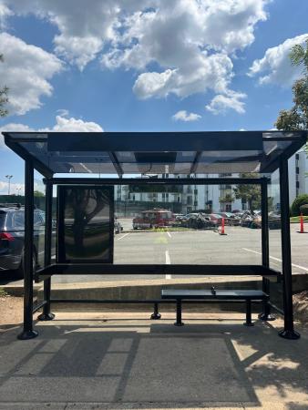
Image of Brasco Eclipse Shelter
The installation of bus shelters is generally based upon ridership data and staff input, but many shelters have been installed as part of development projects.
Bus shelters are important as they provide a place to sit, protection from the weather, and a feeling of security to riders. DASH ridership has hit all time records in ridership every month since July 2022. As bus ridership continues to grow, it is important to install bus shelters at to improve the rider experience.
Real-Time Information Displays
The City has partnered with DASH to install real-time information displays at more than 80 bus stops across the City of Alexandria. The City typically uses Connectpoint Digital Bus Stop displays. These displays provide customers with information on when the next buses will arrive based on real-time bus locations. Most of the displays are solar-powered tablets mounted on bus stop poles, with larger screens or real-time kiosks at major transit hubs or transfer locations.
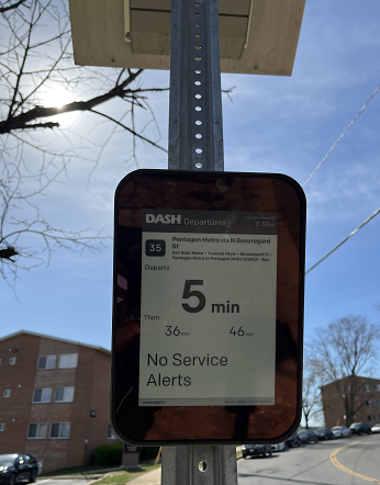
Image of Connectpoint Digital Bus Stop Display
In addition to these real-time information displays, DASH also makes real-time bus arrival information available via the DASH Tracker website, third-party real-time apps, SMS text message, and an interactive voice response on the DASH Customer Service telephone hotline. A static display featuring QR Codes with links to the “Schedules” page on the DASH website is also provided at several dozen bus stop locations.
Benches
Benches are provided at nearly 250 stops throughout the City of Alexandria.
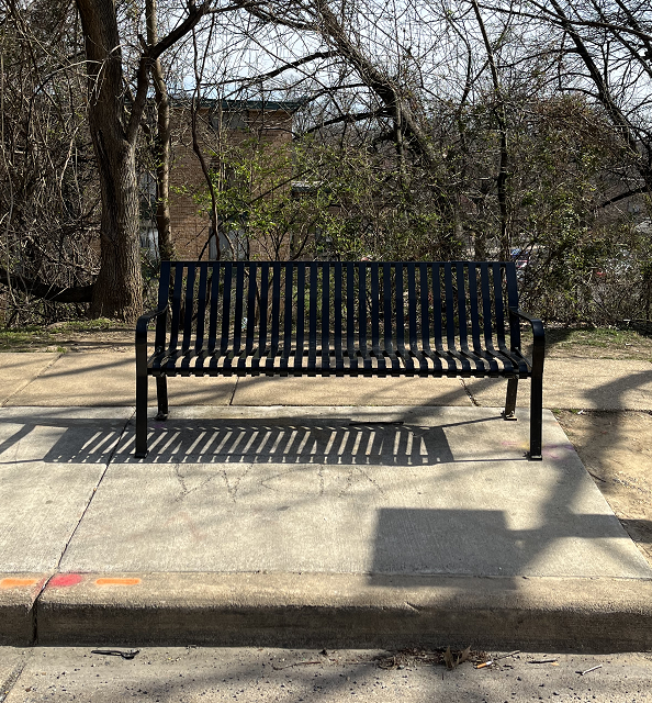
Image of standard Victor Stanley bench
The installation of benches is based upon ridership, customer requests and feasibility of space. Stops located near significant populations of seniors, the disabled, students, or other special uses (e.g., hospitals, medical offices, tourist attractions) may receive special consideration.
Lighting
The City works to install lighting at many of Alexandria’s bus stop locations, including those with bus shelters. Most stops are next to streetlights that provide enough illumination, many stops contain newer shelter models have lights built into them, and several stops have solar lighting displays. The distribution of lighting fixtures is primarily based upon ridership, customer requests, and safety considerations.
Image of solar lighting display
Trash Cans
Trash cans are installed at roughly 300 stops where there is a demonstrated issue with littering, but ridership data, customer requests, maintenance trends and staff input are also considered. Trash cans are regularly maintained by the City of Alexandria’s Department of Transportation & Environmental Services (T&ES).
Important Links and Considerations for Developers
The City’s Standard Bus Shelter Model is the Brasco Eclipse. Developers are usually responsible for installing new bus shelters on or adjacent to their property. These conditions are worked out through the development review process.
More information to be included soon as it is finalized.
Specifications for the Brasco Eclipse can be found below. Note that there are four (4) different sizes.
Bus Stop Maintenance
The City of Alexandria is responsible for ensuring that bus stops are regularly cleaned and maintained to meet basic standards of safety, accessibility, comfort and cleanliness, in close coordination with DASH and WMATA. The perimeter of responsibility extends 6' around the bus shelter.
Alex311 is used for the reporting and resolution of bus stop maintenance issues, including overflowing trash receptacles, broken shelter glass, overgrown foliage, and graffiti.
DASH and WMATA staff also work closely with City staff during winter weather events to prioritize snow removal from bus stops and passenger facilities.
Bus facilities located at the Van Dorn Street, Eisenhower Avenue, and Braddock Road Metrorail stations are maintained by WMATA; however, the bus facilities at the King Street-Old and Potomac Yard-VT Metrorail stations are maintained by the City of Alexandria.
Past Projects
Relevant Links
See below for resourceful links.
Contact
If you have a service request, please contact Alex311.
If you have any questions, please contact Silas Sullivan at silas.sullivan@alexandriava.gov.