Wayfinding: George Washington Memorial Parkway
George Washington Memorial Parkway

Washington Street
A visit to George Washington’s Mount Vernon estate, about nine miles to the south, has long been viewed as a patriotic duty of Americans. In the late 19th century, visitors often traveled there from Washington by boat, stopping first in Alexandria. By 1887, Alexandria business leaders established a “Mount Vernon Avenue Association” to lobby for construction of a federal roadway to reach the estate. As conceived, the park-like boulevard would travel south from Alexandria, passing through a rural area of woodlands and scenic vistas. This route would periodically incorporate a series of landscaped pavilions and monuments, where visitors would learn the history, industry and people associated with each of the 13 original states. But in the years just before the 20th century, a trolley line was built, passing through downtown Alexandria and providing inexpensive travel to Mount Vernon, thwarting the roadway plan.
The road proposal lagged for many years until a plan was developed in the 1920s to build a highway from Arlington’s Memorial Bridge to Mount Vernon, to be called Mount Vernon Boulevard. After consideration of two routes, one along an inland ridge of high ground, the other along the edge of the Potomac, the latter route was selected, using the old trolley right-of-way. The proposal was revised to commemorate the 200th birthday of the nation’s first president in 1932, and renamed the George Washington Memorial Parkway. Within the City of Alexandria, the parkway travels the same path as historic Washington Street, laid out in 1749. Nearly 200 years later, in 1946, the City Council established the “Old and Historic Alexandria District”, America’s third municipal historic district, in part to protect the commemorative nature of the parkway.
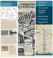
Cover of 1907 Tercentennial Souvenir Illustrated Guide
A view of the proposed Mount Vernon Avenue can be seen on the cover of this commemorative book, which was produced to honor the 300th anniversary of the founding of Jamestown in 1607. Starting at the U. S. Capitol in the upper left-hand corner, the proposed roadway slices on a diagonal across the cover and through Alexandria, to Mount Vernon at the lower right.
Where to find this sign
In Old Town, mini kiosks are located at designated intersections along King Street, Cameron Street, and the Waterfront to provide an orientation for pedestrians.
This wayfinding sign is located on King at the corner of N. Washington Street. (For those taking the King Street Trolley, please check the schedule as times may have changed.)
See all the wayfinding signs on and around King Street.