Historic Alexandria Maps
Full-sized images of these maps can be found at the Library of Congress, Geography and Map Division, except as noted.

![1782, “Amérique Campagne - Camp a’Alexandrie [sic],” Comte de Rochambeau (Library of Congress)](/sites/default/files/styles/gallery_thumbnail/public/2021-11/Map-1782-Rochambeau.jpg?itok=J8JpZoMv)

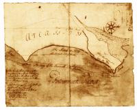
John Smith
"Virginia / discovered and discribed by Captayn John Smith, 1606; graven by William Hole," published London 1624.
Source: Library of Congress, Geography and Map Division.
Call Number: G3880 1624 .S541 Vault
Digital ID: g3880.ct000377

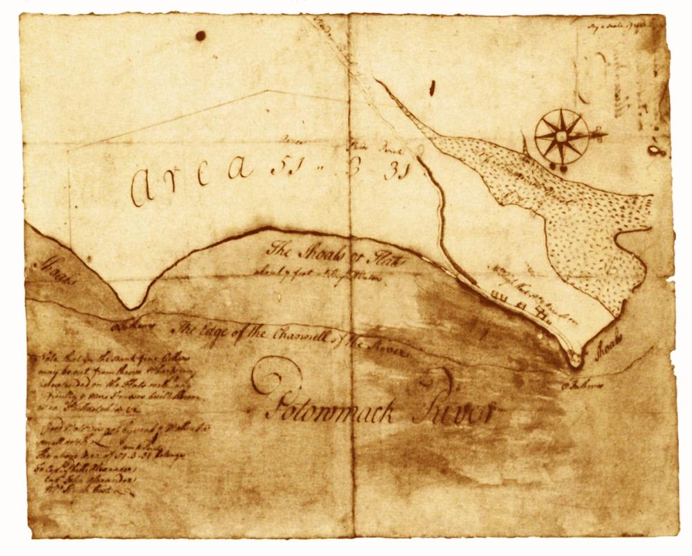
Source: Book of Surveys, 1746, Fairfax County Courthouse
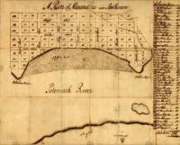
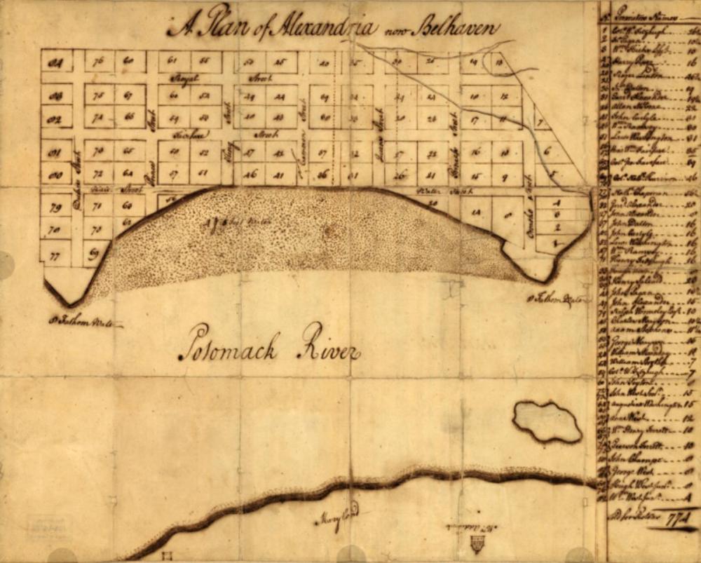
George Washington
Source: Library of Congress, Geography and Map Division.
Call Number: G3884.A3 1748 .W3 Vault
Digital ID: (recto) g3884a.ct000368r; (verso) g3884a.ct000368v
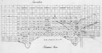
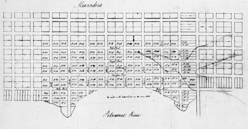
George Washington
Source: Library of Congress, Geography and Map Division.
Call Number G3884.A4 1763.W4 Vault
George West
Source: Library of Congress, Geography and Map Division.
Call Number G3884.A4 1763.W4 Vault
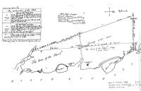
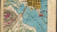
![1782, “Amérique Campagne - Camp a’Alexandrie [sic],” Comte de Rochambeau (Library of Congress)](/sites/default/files/styles/gallery_item/public/2021-11/Map-1782-Rochambeau.jpg?itok=wSJsy6EC)
Comte de Rochambeau
From Amérique Campagne, an atlas of 40 maps
Source: Library of Congress, Geography and Map Division.
Call Number: G1201.S3 R65 1782 Vault : Roch 67
Digital ID: g3701sm gar00001
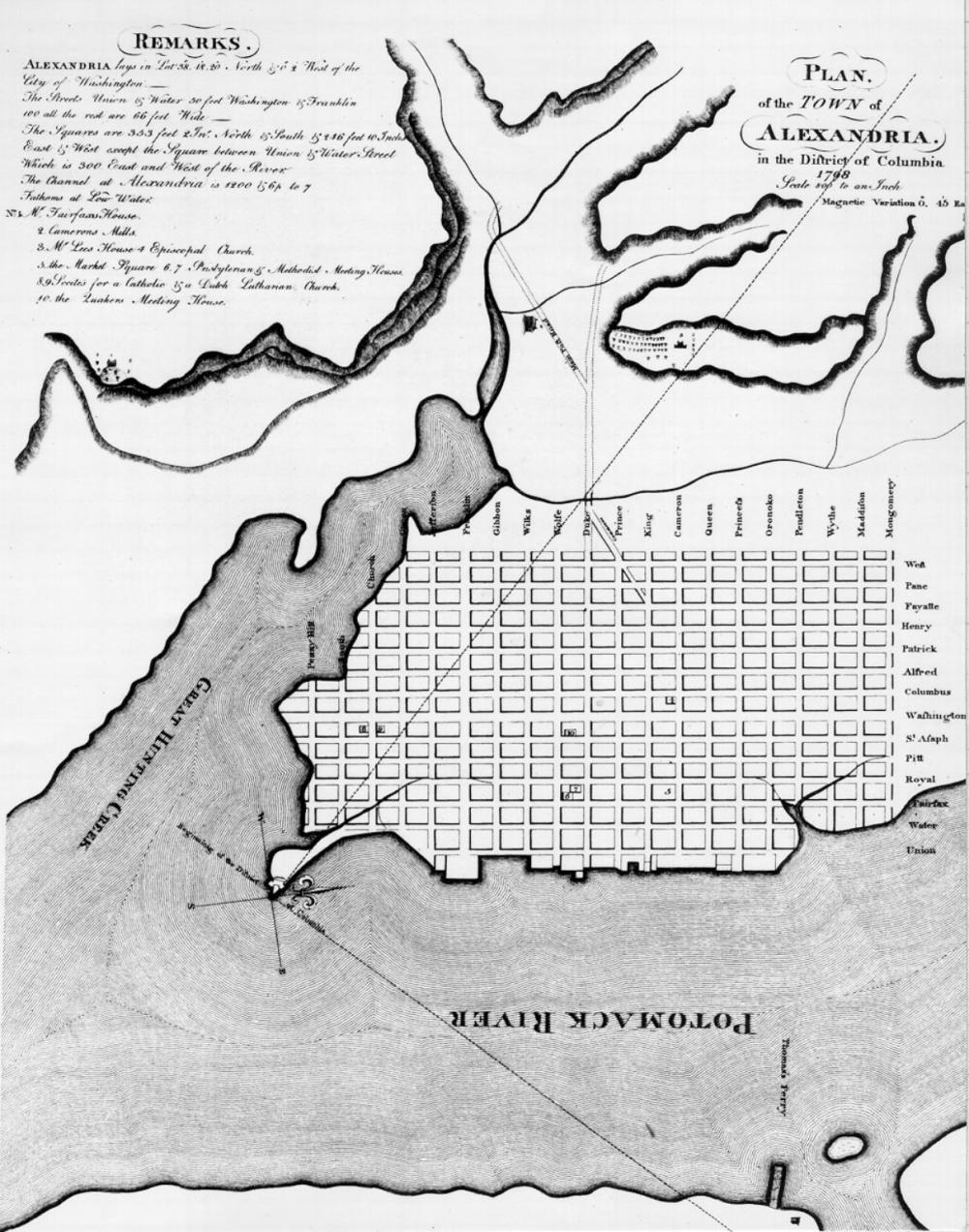
Colonel George Gilpin
Source: Library of Congress, Geography and Map Division.
Call Number: G3884.A3 1798 .G5 Vault
Digital ID: g3884a.ct001432
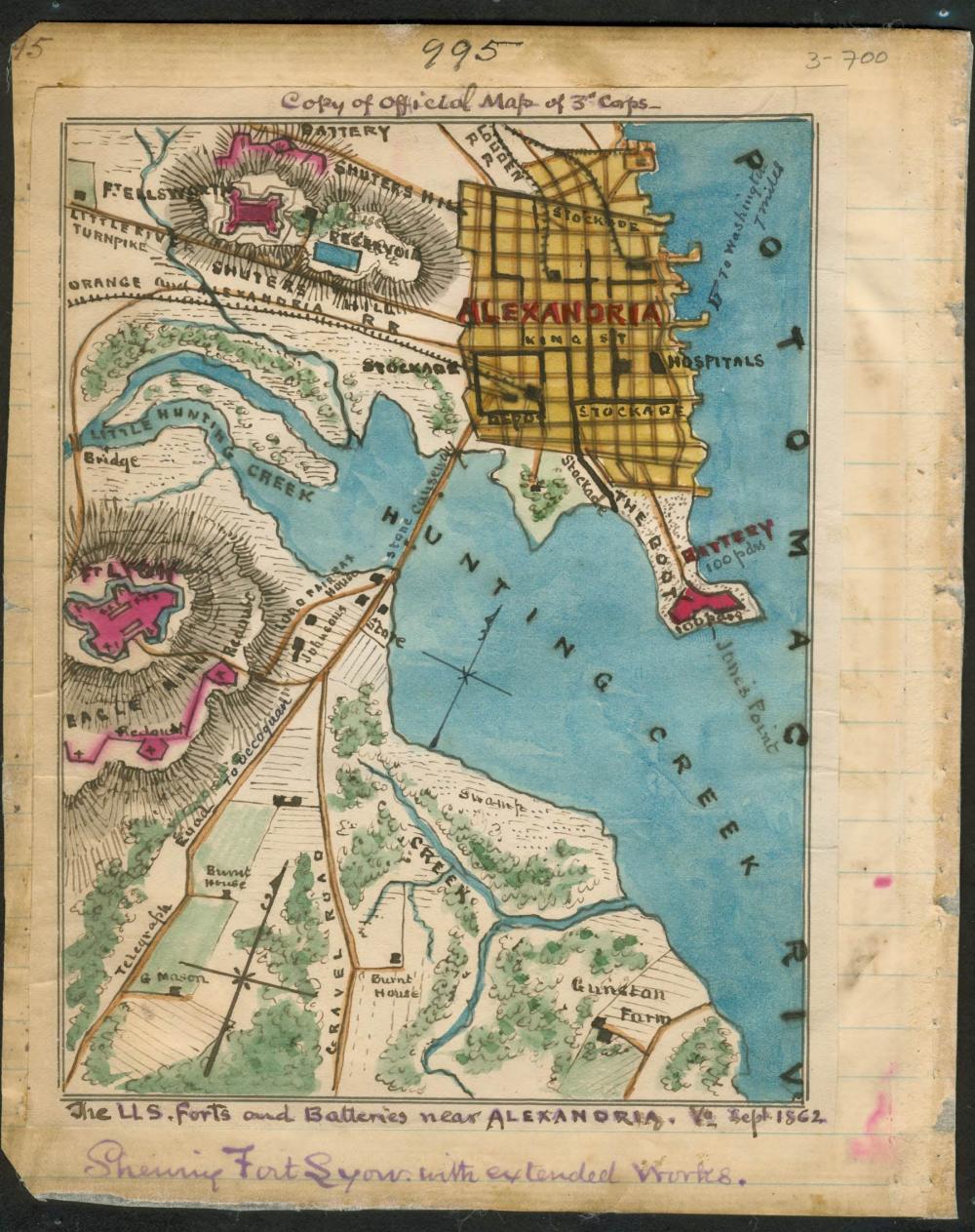
Showing Fort Lyon with extended works
Robert Knox Sneden
Source: Library of Congress, Geography and Map Division.
Repository: Virginia Historical Society
Digital ID: gvhs01 vhs00110